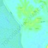
Topografische Karte Jingdezhen
Klicken Sie auf die Karte, um die Höhe anzuzeigen.
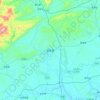
Jingdezhen
Jingdezhen is situated in the north-east of Jiangxi and borders on Anhui; the city center area is located in the north-east of the Poyang Lake Plain. Its area is 5,256 km2 (2,029 sq mi). The highest point is 1,618 m (5,308 ft), with plains on the southern part having an average altitude of 200 m (660 ft).
Über diese Karte

Name: Topografische Karte Jingdezhen, Höhe, Relief.
Ort: Jingdezhen, Jiangxi, 333403, China (28.72233 116.95213 29.93317 117.70450)
Durchschnittliche Höhe: 167 m
Minimale Höhe: 8 m
Maximale Höhe: 1’603 m
Andere topografische Karten
Klicken Sie auf eine Karte, um ihre Topografie, ihre Höhe und ihr Relief anzuzeigen.







Jingdezhen
Jingdezhen is situated in the north-east of Jiangxi and borders on Anhui; the city center area is located in the north-east of the Poyang Lake Plain. Its area is 5,256 km2 (2,029 sq mi).[10] The highest point is 1,618 m (5,308 ft), with plains on the southern part having an average altitude of 200 m (660 ft).
Durchschnittliche Höhe: 100 m