
Topografische Karte Păltiniș
Interaktive Karte
Klicken Sie auf die Karte, um die Höhe anzuzeigen.
Über diese Karte
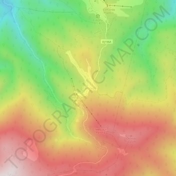
Name: Topografische Karte Păltiniș, Höhe, Relief.
Ort: Păltiniș, Sibiu, 550001, Romania (45.63305 23.91198 45.67305 23.95198)
Durchschnittliche Höhe: 1’405 m
Minimale Höhe: 936 m
Maximale Höhe: 1’837 m
It is situated at 1440 m altitude, being the highest resort in Romania. It lies in a conifer forest. It is a popular winter destination and in summer it is sought for its peacefulness, fresh air and easily accessible trekking routes.