
Topografische Karte Anadarko
Interaktive Karte
Klicken Sie auf die Karte, um die Höhe anzuzeigen.
Über diese Karte
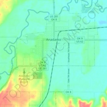
Name: Topografische Karte Anadarko, Höhe, Relief.
Ort: Anadarko, Caddo County, Oklahoma, 73005, United States (35.03484 -98.27944 35.09436 -98.21401)
Durchschnittliche Höhe: 369 m
Minimale Höhe: 351 m
Maximale Höhe: 420 m
Andere topografische Karten
Klicken Sie auf eine Karte, um ihre Topografie, ihre Höhe und ihr Relief anzuzeigen.
Fort Cobb
United States > Oklahoma > Caddo County > Fort Cobb
Fort Cobb, Caddo County, Oklahoma, 73038, United States
Durchschnittliche Höhe: 390 m
Washita
United States > Oklahoma > Caddo County > Washita
Washita, Caddo County, Oklahoma, United States
Durchschnittliche Höhe: 382 m
Indian City
United States > Oklahoma > Caddo County > Indian City
Indian City, Caddo County, Oklahoma, 73005, United States
Durchschnittliche Höhe: 386 m