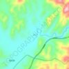
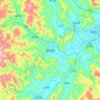
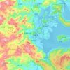
Topografische Karte Dehua County
Klicken Sie auf die Karte, um die Höhe anzuzeigen.
Über diese Karte

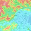
Name: Topografische Karte Dehua County, Höhe, Relief.
Ort: Dehua County, Quanzhou, Fujian, 362500, China (25.39929 117.93193 25.94330 118.54813)
Durchschnittliche Höhe: 696 m
Minimale Höhe: 122 m
Maximale Höhe: 1’812 m
Andere topografische Karten
Klicken Sie auf eine Karte, um ihre Topografie, ihre Höhe und ihr Relief anzuzeigen.



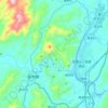
Wuyishan Scenic and Historic Interest Area
China > Fujian > Wuyishan > Wuyi
Durchschnittliche Höhe: 302 m










Sansha
China > Fujian > Xiapu County
The land around Sansha is mostly hilly, but to the south it is flat. To the southeast, the sea is closest to Sansha. The highest point in the vicinity has an elevation of 516 meters and is 2.3 km northwest of Sansha. Sansha is the largest town in the area. In the region around Sansha, islands are unusually…
Durchschnittliche Höhe: 79 m