
Topografische Karte Travis Park
Interaktive Karte
Klicken Sie auf die Karte, um die Höhe anzuzeigen.
Über diese Karte
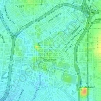
Name: Topografische Karte Travis Park, Höhe, Relief.
Durchschnittliche Höhe: 204 m
Minimale Höhe: 195 m
Maximale Höhe: 230 m
Andere topografische Karten
Klicken Sie auf eine Karte, um ihre Topografie, ihre Höhe und ihr Relief anzuzeigen.
San Pedro Springs Park
United States > Texas > Bexar County > San Antonio
San Pedro Springs Park, 2200, San Antonio, Bexar County, Texas, 78212, United States
Durchschnittliche Höhe: 214 m
Olmos Basin Park
United States > Texas > Bexar County > San Antonio
Olmos Basin Park, 651, San Antonio, Bexar County, Texas, 78209, United States
Durchschnittliche Höhe: 229 m
San Antonio
United States > Texas > Bexar County > San Antonio
San Antonio, Bexar County, Texas, 78205, United States
Durchschnittliche Höhe: 218 m
River Walk
United States > Texas > Bexar County > San Antonio
River Walk, Downtown, San Antonio, Bexar County, Texas, United States
Durchschnittliche Höhe: 203 m
Government Canyon State Natural Area
United States > Texas > Bexar County > San Antonio
Government Canyon State Natural Area, 12861, Galm Road, San Antonio, Bexar County, Texas, 78254, United States
Durchschnittliche Höhe: 357 m
Tom Slick Park
United States > Texas > Bexar County > San Antonio
Tom Slick Park, San Antonio, Bexar County, Texas, United States
Durchschnittliche Höhe: 229 m
Eisenhower Park
United States > Texas > Bexar County > San Antonio
Eisenhower Park, San Antonio, Bexar County, Texas, 78257, United States
Durchschnittliche Höhe: 345 m
Leon Creek
United States > Texas > Bexar County > San Antonio
Leon Creek, Leon Springs, San Antonio, Bexar County, Texas, 78257, United States
Durchschnittliche Höhe: 361 m
Hardberger Park
United States > Texas > Bexar County > San Antonio
Hardberger Park, San Antonio, Bexar County, Texas, 78216, United States
Durchschnittliche Höhe: 271 m
Farias Park
United States > Texas > Bexar County > San Antonio
Farias Park, San Antonio, Bexar County, Texas, 78207, United States
Durchschnittliche Höhe: 206 m