
Topografische Karte Horseshoe Bend
Interaktive Karte
Klicken Sie auf die Karte, um die Höhe anzuzeigen.
Horseshoe Bend
The Horseshoe Bend Airport, FAA identifier is 6M2, is owned and operated by the city. The runway is 4,524 ft. x 60 ft. and is paved. It is located at 36°13′3″N 91°45′3″W / 36.21750°N 91.75083°W / 36.21750; -91.75083 (36.2213694, -91.7554833) at an elevation of 782 ft. / 238 m. Its variation is 03E.
Über diese Karte
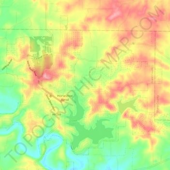
Name: Topografische Karte Horseshoe Bend, Höhe, Relief.
Ort: Horseshoe Bend, Izard County, Arkansas, 72512, United States (36.19148 -91.79236 36.26120 -91.68736)
Durchschnittliche Höhe: 220 m
Minimale Höhe: 160 m
Maximale Höhe: 284 m