
Topografische Karte Bloomfield
Interaktive Karte
Klicken Sie auf die Karte, um die Höhe anzuzeigen.
Über diese Karte
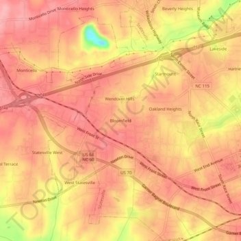
Name: Topografische Karte Bloomfield, Höhe, Relief.
Durchschnittliche Höhe: 279 m
Minimale Höhe: 197 m
Maximale Höhe: 307 m
Andere topografische Karten
Klicken Sie auf eine Karte, um ihre Topografie, ihre Höhe und ihr Relief anzuzeigen.
Shannon Acres
United States > North Carolina > Iredell County > Statesville
Shannon Acres, Statesville, Iredell County, North Carolina, United States
Durchschnittliche Höhe: 254 m
Statesville
United States > North Carolina > Iredell County > Statesville > Statesville
Statesville, Iredell County, North Carolina, 28687, United States
Durchschnittliche Höhe: 266 m