

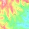
Topografische Karte Leverett
Klicken Sie auf die Karte, um die Höhe anzuzeigen.
Leverett
According to the United States Census Bureau, the town has a total area of 23.0 square miles (60 km2), of which 22.9 square miles (59 km2) are land and 0.1-square-mile (0.26 km2) (0.61%) is water. Leverett is located on the edge of the Pioneer Valley and the hills of northwestern Massachusetts, just east of the Connecticut River. The southwestern corner of town is relatively flat plains, while the rest is dominated by hills, the tallest of which is Brushy Mountain, with an elevation of 1,260 feet (380 m).
Über diese Karte
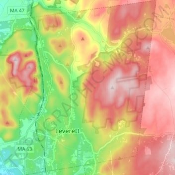
Name: Topografische Karte Leverett, Höhe, Relief.
Durchschnittliche Höhe: 220 m
Minimale Höhe: 45 m
Maximale Höhe: 384 m
Andere topografische Karten
Klicken Sie auf eine Karte, um ihre Topografie, ihre Höhe und ihr Relief anzuzeigen.

Pratt Corner
United States > Massachusetts > Franklin County > Shutesbury
Durchschnittliche Höhe: 195 m
North Sunderland
United States > Massachusetts > Franklin County > Sunderland
Durchschnittliche Höhe: 100 m

North Leverett
United States > Massachusetts > Franklin County > Leverett
Durchschnittliche Höhe: 215 m

Baptist Corner
United States > Massachusetts > Franklin County > Ashfield
Durchschnittliche Höhe: 325 m