Topografische Karte Wenzhou
Klicken Sie auf die Karte, um die Höhe anzuzeigen.
Wenzhou
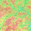
Most of Wenzhou's landscape is mountainous, with many mountain tops reaching altitudes in excess of 1,000 m (3,300 ft), for example in the Yandang Mountains, a coastal mountain range dominating the eastern part of prefecture. Another dominating landscape element is the Ou River, the largest river in Wenzhou prefecture. There are some coastal plains, notably around the mouth of the Ou (where the city proper of Wenzhou is located), the Nanxi River, a tributary of the Ou, and further south, around the mouth of the Feiyun River (in Rui'an, a county-level city). Coastal plains are used intensively for agriculture but also host much of the population and industry.
Über diese Karte
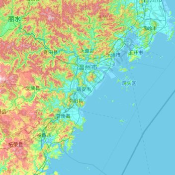
Name: Topografische Karte Wenzhou, Höhe, Relief.
Ort: Wenzhou, Zhejiang, China (26.96481 119.62023 28.61525 121.55736)
Durchschnittliche Höhe: 217 m
Minimale Höhe: -4 m
Maximale Höhe: 1’483 m
Andere topografische Karten
Klicken Sie auf eine Karte, um ihre Topografie, ihre Höhe und ihr Relief anzuzeigen.