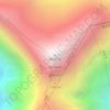
Topografische Karte Shuanghu County
Klicken Sie auf die Karte, um die Höhe anzuzeigen.
Shuanghu County
Shuanghu County (Chinese: 双湖县), also transliterated from Tibetan as Tsonyi County or Co Nyi County (Tibetan: མཚོ་གཉིས་རྫོང་།), is a county under the jurisdiction of the prefecture-level city of Nagqu, in the northernmost part of the Tibet Autonomous Region, China. It was formed in 2012, combining the territory of the former Shuanghu Special District (Chinese: 双湖特别区, Tibetan: མཚོ་གཉིས་དམིགས་བསལ་སྲིད་འཛིན་ཁུལ་) with the eastern half of Nyima County. Much of the county is within the Changtang area. Shuanghu is the highest county of China with an average elevation of more than 5,000 metres (16,000 ft), while its county seat is located at 4,920 metres (16,140 ft).
Über diese Karte

Name: Topografische Karte Shuanghu County, Höhe, Relief.
Ort: Shuanghu County, Nagqu City, Xizang, China (31.64274 86.06724 36.48407 90.37519)
Durchschnittliche Höhe: 5’015 m
Minimale Höhe: 4’465 m
Maximale Höhe: 6’544 m
Andere topografische Karten
Klicken Sie auf eine Karte, um ihre Topografie, ihre Höhe und ihr Relief anzuzeigen.
Mount Kailash
China > Xizang > Purang County > Parga town
Mount Kailash (also Kailasa; Kangrinboqê or Gang Rinpoche; Tibetan: གངས་རིན་པོ་ཆེ; simplified Chinese: 冈仁波齐峰; traditional Chinese: 岡仁波齊峰; Sanskrit: कैलास, IAST: Kailāsa), is a mountain in the Ngari Prefecture, Tibet Autonomous Region of China. It has an…
Durchschnittliche Höhe: 5’756 m
Chumbi Valley
China > Xizang > Yadong County > Xiayadong Township > Rinchengang
The valley is at an altitude of 3,000 m (9,800 ft), and being on the south side of the Himalayas, enjoys a wetter and more temperate climate than most of Tibet. The valley supports some vegetation in the form of the Eastern Himalayan broadleaf forests and transitions to the Eastern Himalayan alpine shrub and…
Durchschnittliche Höhe: 3’076 m