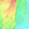
Topografische Karte Ameno
Klicken Sie auf die Karte, um die Höhe anzuzeigen.
Ameno
The municipal area is located on a large plateau overlooking the eastern shore of Lake Orta. The village is surrounded by coppiced woods and is a popular destination for summer holidays with numerous houses located along the road running between the mountain and the lake. The territory has an elevation ranging from 380 to 788 meters. This measurement includes the hills that divide Lake Orta from the Agogna Valley and the capital in the centre and further down into the region of Vacciago, with its small villages of Vacciaghetto and Lortallo. Ameno became sister cities in 2007 with the French commune of Commelle-Vernay. The region is part of the mountain community with various other cities such as: Due Laghi, Cusio Mottarone, and Valstrona. On 26 September 2012, the region joined the: "Borgo sostenibile del Piemonte" - a program for more responsible tourism, which local communities around the area had created to encourage implementing good environmental practices.
Über diese Karte

Name: Topografische Karte Ameno, Höhe, Relief.
Ort: Ameno, Novara, Piedmont, Italy (45.77037 8.42472 45.80289 8.48284)
Durchschnittliche Höhe: 468 m
Minimale Höhe: 285 m
Maximale Höhe: 784 m
Andere topografische Karten
Klicken Sie auf eine Karte, um ihre Topografie, ihre Höhe und ihr Relief anzuzeigen.