
Topografische Karte Chakan
Klicken Sie auf die Karte, um die Höhe anzuzeigen.
Chakan
Shiroli Chandus village, located 6 km north of Chakan, had been identified as the probable site for the proposed Pune International Airport, but due to the protests by the villagers & uneven topography, the site has been shifted to Purandar.
Über diese Karte
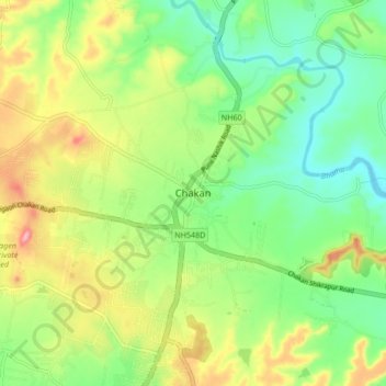
Name: Topografische Karte Chakan, Höhe, Relief.
Ort: Chakan, Khed, Pune, Maharashtra, 410500, India (18.72231 73.82254 18.80231 73.90254)
Durchschnittliche Höhe: 624 m
Minimale Höhe: 568 m
Maximale Höhe: 712 m