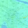
Topografische Karte Lianyungang
Klicken Sie auf die Karte, um die Höhe anzuzeigen.
Lianyungang
Lianyungang City, where Huaguoshan Scenic Area is located, is located in the middle of China's thousands of miles of maritime territory, in the northeast of Jiangsu Province, bordering the Yellow Sea to the east, the Central Plains to the west, Qilu to the north, Jianghuai to the south, and facing Japan and the Korean Peninsula across the sea. The scenic area covers an area of 75.39 square kilometers and has 136 peaks. Among them, the Yunu Peak of Huaguo Mountain is the highest peak in Jiangsu Province, with an altitude of 624.4 meters and majestic cliffs.
Über diese Karte

Name: Topografische Karte Lianyungang, Höhe, Relief.
Ort: Lianyungang, Jiangsu, China (33.98548 118.39555 35.14704 119.93028)
Durchschnittliche Höhe: 17 m
Minimale Höhe: -3 m
Maximale Höhe: 563 m
Andere topografische Karten
Klicken Sie auf eine Karte, um ihre Topografie, ihre Höhe und ihr Relief anzuzeigen.