
Topografische Karte LaFollette
Interaktive Karte
Klicken Sie auf die Karte, um die Höhe anzuzeigen.
Über diese Karte
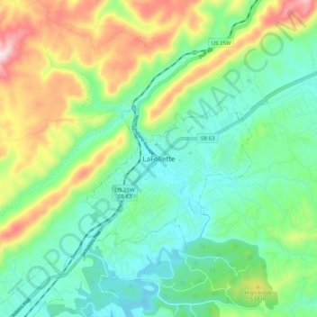
Name: Topografische Karte LaFollette, Höhe, Relief.
Durchschnittliche Höhe: 435 m
Minimale Höhe: 301 m
Maximale Höhe: 726 m
According to the United States Census Bureau, the city has a total area of 4.9 sq mi (12.7 km2), all land. The elevation varies around the city, around 1,050 ft (320 m) in the valley areas to 1,500 ft (460 m) on ridge tops. The average elevation is around 1,150 ft (350 m).