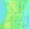
Topografische Karte Lakeland
Klicken Sie auf die Karte, um die Höhe anzuzeigen.
Lakeland
Lakeland is characterized by its gently rolling terrain, which is dotted with numerous lakes that contribute to the region's scenic beauty. The area is part of the Central Florida Highlands, with elevations generally ranging from 100 to 250 feet above sea level. The topography is marked by a mix of flatlands and subtle hills, providing a diverse landscape that includes lush wetlands and woodlands. This varied terrain supports a rich ecosystem, featuring a mix of pine forests, cypress swamps, and open grasslands. The lakes, including the prominent Lake Parker and Lake Mirror, play a crucial role in the local environment, serving as both recreational areas and vital habitats for wildlife. Overall, Lakeland's topography offers a unique blend of natural beauty and outdoor recreational opportunities, making it a picturesque locale in central Florida.
Über diese Karte
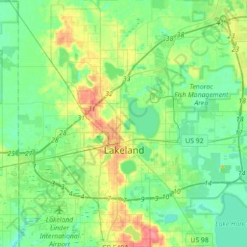
Name: Topografische Karte Lakeland, Höhe, Relief.
Ort: Lakeland, Polk County, Florida, United States (27.95267 -82.05610 28.17197 -81.83880)
Durchschnittliche Höhe: 44 m
Minimale Höhe: 27 m
Maximale Höhe: 84 m
Andere topografische Karten
Klicken Sie auf eine Karte, um ihre Topografie, ihre Höhe und ihr Relief anzuzeigen.

Allen David Broussard Catfish Creek Preserve State Park
United States > Florida > Polk County
Durchschnittliche Höhe: 18 m







Lake Wales
United States > Florida > Polk County > Lake Wales > Lake Wales
Durchschnittliche Höhe: 44 m







Lakeland Highlands
United States > Florida > Polk County > Lakeland Highlands
Durchschnittliche Höhe: 64 m