
Topografische Karte Kevil
Interaktive Karte
Klicken Sie auf die Karte, um die Höhe anzuzeigen.
Über diese Karte
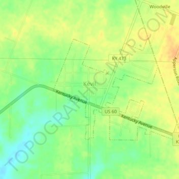
Name: Topografische Karte Kevil, Höhe, Relief.
Ort: Kevil, Ballard County, Kentucky, United States (37.07633 -88.89359 37.09199 -88.86832)
Durchschnittliche Höhe: 132 m
Minimale Höhe: 115 m
Maximale Höhe: 145 m
Andere topografische Karten
Klicken Sie auf eine Karte, um ihre Topografie, ihre Höhe und ihr Relief anzuzeigen.
Slater
United States > Kentucky > Ballard County
Slater, Ballard County, Kentucky, United States
Durchschnittliche Höhe: 135 m
Barlow
United States > Kentucky > Ballard County
Barlow, Ballard County, Kentucky, United States
Durchschnittliche Höhe: 110 m
La Center
United States > Kentucky > Ballard County
La Center, Ballard County, Kentucky, United States
Durchschnittliche Höhe: 111 m
Wickliffe
United States > Kentucky > Ballard County
Wickliffe, Ballard County, Kentucky, United States
Durchschnittliche Höhe: 110 m