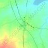
Topografische Karte Odanthurai
Klicken Sie auf die Karte, um die Höhe anzuzeigen.
Über diese Karte

Name: Topografische Karte Odanthurai, Höhe, Relief.
Durchschnittliche Höhe: 365 m
Minimale Höhe: 282 m
Maximale Höhe: 1’056 m
Andere topografische Karten
Klicken Sie auf eine Karte, um ihre Topografie, ihre Höhe und ihr Relief anzuzeigen.
Mettupalayam
India > Tamil Nadu > Mettupalayam
Mettupalayam is located at 11°18′00″N 76°57′00″E / 11.3000°N 76.9500°E / 11.3000; 76.9500. It has an average elevation of 314 metres (1033 feet). Mettupalayam is situated on the bank of Bhavani River at the foot of the Nilgiri mountains.
Durchschnittliche Höhe: 321 m



Mettupalayam
India > Tamil Nadu > Mettupalayam
Mettupalayam is located at 11°18′20″N 76°56′06″E / 11.3056°N 76.9350°E / 11.3056; 76.9350. It has an average elevation of 314 m (1,030 ft). Mettupalayam is situated on the bank of Bhavani River at the foot of the Nilgiri mountains.
Durchschnittliche Höhe: 321 m
Bhavani
India > Tamil Nadu > Mettupalayam
The Bhavani is a 234 km (145 mi) long perennial river fed by monsoons. The river originates at an altitude of 2,634 m (8,642 ft) in the Billimala range of the Nilgiris in the Western Ghats in Tamil Nadu. It flows westwards towards the Silent Valley National Park in Kerala, before later turning eastwards and…
Durchschnittliche Höhe: 923 m
Mettupalayam
India > Tamil Nadu > Mettupalayam
Mettupalayam is located at 11°18′20″N 76°56′06″E / 11.3056°N 76.9350°E / 11.3056; 76.9350. It has an average elevation of 314 m (1,030 ft). Mettupalayam is situated on the bank of Bhavani River at the foot of the Nilgiri mountains.
Durchschnittliche Höhe: 321 m