
Topografische Karte Euroa
Klicken Sie auf die Karte, um die Höhe anzuzeigen.
Über diese Karte
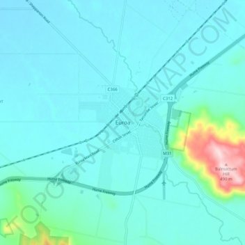
Name: Topografische Karte Euroa, Höhe, Relief.
Ort: Euroa, Shire of Strathbogie, Victoria, 3666, Australia (-36.79276 145.52876 -36.71276 145.60876)
Durchschnittliche Höhe: 200 m
Minimale Höhe: 159 m
Maximale Höhe: 491 m
Andere topografische Karten
Klicken Sie auf eine Karte, um ihre Topografie, ihre Höhe und ihr Relief anzuzeigen.
City of Melbourne
Melbourne's topography is characterized by a diverse landscape that transitions from flat coastal plains to rolling hills and mountainous regions. The city is situated at the northern end of Port Phillip Bay, where the terrain is predominantly flat, facilitating urban development. As one moves eastward, the…
Durchschnittliche Höhe: 18 m
Melbourne
Melbourne is also prone to isolated convective showers forming when a cold pool crosses the state, especially if there is considerable daytime heating. These showers are often heavy and can include hail, squalls, and significant drops in temperature, but they often pass through very quickly with a rapid…
Durchschnittliche Höhe: 185 m
Bairnsdale
A comprehensive geological survey of Victoria's Great Dividing Range reveals a distinct north-south alignment in its bedrock, a vestige of the bygone epochs of plate tectonics. This enduring geological framework, coupled with ongoing tectonic activity, contributes to the dynamic topography witnessed in the…
Durchschnittliche Höhe: 25 m
Grampians National Park
Mount William is known within the gliding community for the "Grampians Wave", a weather phenomenon that sometimes enables glider pilots to reach extreme altitudes of the order of 28,000 ft (8,500 m). This predominantly occurs during the months of May, June, September and October when strong westerly winds flow…
Durchschnittliche Höhe: 262 m
Port Phillip
Port Phillip's mostly flat topography and moderate waves make perfect conditions for recreational swimming, kitesurfing, windsurfing, sailing, boating, snorkeling, scuba diving, stand up paddle boarding (SUP) and other sports.
Durchschnittliche Höhe: 18 m
Falls Creek
Australia > Victoria > Falls Creek Alpine Resort
The Falls Creek Alpine Resort is an alpine ski resort in the Hume region in northeastern Victoria, Australia. It is located in the Alpine National Park in the Victorian Alps, approximately 350 kilometres (220 miles) by road from Melbourne, with the nearest town being Mount Beauty, which is approximately 30 km…
Durchschnittliche Höhe: 1’459 m
Falls Creek
The Falls Creek Alpine Resort is an alpine ski resort in the Hume region in northeastern Victoria, Australia. It is located in the Alpine National Park in the Victorian Alps, approximately 350 kilometres (220 miles) by road from Melbourne, with the nearest town Mount Beauty, approximately 30 km (20 mi) away.…
Durchschnittliche Höhe: 1’459 m
Lancefield
Lancefield's elevation and climate made it a popular summer resort in the 1880s. In recent years, many local wineries have been established in the area.
Durchschnittliche Höhe: 530 m
Trentham
Trentham is a small town in the Shire of Hepburn and Shire of Moorabool local government area, Victoria, Australia. At the 2016 census, Trentham had a population of 1,180, with a median age of 55 years. Located at an altitude of 700 metres (2,297 ft), the town is 87 kilometres (54 mi) north-west of Melbourne.
Durchschnittliche Höhe: 702 m