
Topografische Karte Fraserburg
Interaktive Karte
Klicken Sie auf die Karte, um die Höhe anzuzeigen.
Über diese Karte
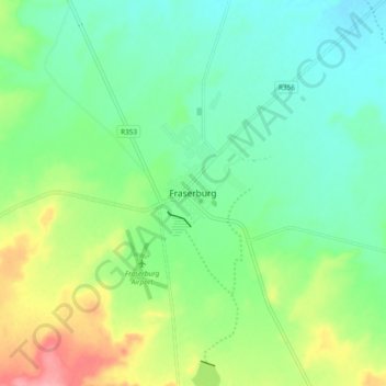
Name: Topografische Karte Fraserburg, Höhe, Relief.
Durchschnittliche Höhe: 1’268 m
Minimale Höhe: 1’234 m
Maximale Höhe: 1’342 m
Fraserburg is situated at an altitude of 1,385 metres (4,544 ft) above sea level on a high Karoo plateau, north of the Nuweveld Mountains.
Andere topografische Karten
Klicken Sie auf eine Karte, um ihre Topografie, ihre Höhe und ihr Relief anzuzeigen.
Karoo Hoogland Local Municipality
South Africa > Northern Cape > Namakwa District Municipality > Karoo Hoogland Local Municipality
Karoo Hoogland Local Municipality, Namakwa District Municipality, Northern Cape, 6960, South Africa
Durchschnittliche Höhe: 1’101 m