

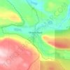
Topografische Karte Pavilion
Klicken Sie auf die Karte, um die Höhe anzuzeigen.
Pavilion
The early anglicized version of the village name was Skwailuk, meaning hoar-frost, perhaps indicating the shaded ground remaining frozen during the long winters at this elevation. The Ts'kw'aylaxw First Nation (a.k.a. the Tsk'waylacw First Nation or Tsk'weylecw First Nation), residing on the Pavilion 1 Indian Reserve comprise most of the area population. The Pavilion dialect is a mix of St'at'imcets and Secwepemc'tsn and many of the place names in the surrounding country are Secwepemc'tsn.
Über diese Karte

Name: Topografische Karte Pavilion, Höhe, Relief.
Ort: Pavilion, British Columbia, Canada (50.86295 -121.84815 50.90295 -121.80815)
Durchschnittliche Höhe: 855 m
Minimale Höhe: 240 m
Maximale Höhe: 1’241 m
Andere topografische Karten
Klicken Sie auf eine Karte, um ihre Topografie, ihre Höhe und ihr Relief anzuzeigen.
Vancouver
Canada > British Columbia > Metro Vancouver Regional District
Vancouver, British Columbia, is situated on the Burrard Peninsula, bordered by Burrard Inlet to the north and the Fraser River to the south. The city's topography is a blend of flat and hilly terrains, with elevations ranging from sea level to approximately 152 meters (500 feet) above sea level. The North…
Durchschnittliche Höhe: 34 m
Victoria
Canada > British Columbia > Capital Regional District
Victoria, British Columbia, is situated on the southern tip of Vancouver Island, Canada, and boasts a diverse and varied topography. The city is characterized by rolling hills, rugged coastal cliffs, and lush valleys, providing a striking contrast between mountainous terrain and flatland areas. To the north…
Durchschnittliche Höhe: 17 m
Kelowna
Canada > British Columbia > Regional District of Central Okanagan
Kelowna is classified as a humid continental climate or an inland oceanic climate per the Köppen climate classification system due to its coldest month having an average temperature slightly above −3.0 °C (26.6 °F) and below 0 °C (32 °F), with dry, hot, sunny summers and cool, cloudy winters, and four…
Durchschnittliche Höhe: 704 m
Burnaby
Canada > British Columbia > Metro Vancouver Regional District
Burnaby occupies 98.6 square kilometres (38.1 sq mi) and is located at the geographic centre of the Metro Vancouver Regional District. The regional district's government is located in Burnaby's Metrotown area. Situated between the city of Vancouver on the west and Port Moody, Coquitlam, and New Westminster on…
Durchschnittliche Höhe: 59 m
Vancouver Island
The rain shadow effect of the island's mountains, as well as the mountains of Washington's Olympic Peninsula, creates wide variation in precipitation. The west coast is considerably wetter than the east coast. Average annual precipitation ranges from 6,650 mm (262 in) at Hucuktlis Lake on the west coast…
Durchschnittliche Höhe: 411 m
West Vancouver
Canada > British Columbia > Metro Vancouver Regional District
Durchschnittliche Höhe: 384 m
Koksilah River
Canada > British Columbia > Cowichan Valley Regional District > Area B (Shawnigan Lake)
Durchschnittliche Höhe: 171 m
Prince Rupert
Canada > British Columbia > North Coast Regional District
Prince Rupert Airport (YPR/CYPR) is on Digby Island. Its position is 54°17′10″N 130°26′41″W / 54.28611°N 130.44472°W / 54.28611; -130.44472, and its elevation is 35 m (116 ft) above sea level. The airport consists of one runway, one passenger terminal, and two aircraft stands. Access to…
Durchschnittliche Höhe: 91 m
West Kelowna
Canada > British Columbia > Regional District of Central Okanagan
Durchschnittliche Höhe: 649 m
Vancouver
Canada > British Columbia > Metro Vancouver Regional District
Vancouver, British Columbia, is situated on the Burrard Peninsula, bordered by Burrard Inlet to the north and the Fraser River to the south. The city's topography is a blend of flat and hilly terrains, with elevations ranging from sea level to approximately 152 meters (500 feet) above sea level. The North…
Durchschnittliche Höhe: 34 m

Kootenay Lake
Canada > British Columbia > Regional District of Central Kootenay
Durchschnittliche Höhe: 1’609 m

Lake Country
Canada > British Columbia > Regional District of Central Okanagan
Durchschnittliche Höhe: 650 m

Port Moody
Canada > British Columbia > Metro Vancouver Regional District
Durchschnittliche Höhe: 189 m

Penticton
Canada > British Columbia > Regional District of Okanagan-Similkameen
Penticton is located at the geographical coordinates of 49°29′28″N 119°35′19″W / 49.49111°N 119.58861°W / 49.49111; -119.58861 (Penticton) and covers an area of 42.10 km2 (16.25 sq mi), with a maximum north–south distance of 7 km (4.3 mi) wide between the Okanagan Lake to the north…
Durchschnittliche Höhe: 702 m
Salmon Arm
Canada > British Columbia > Columbia-Shuswap Regional District
Durchschnittliche Höhe: 620 m

Chetwynd
Canada > British Columbia > Peace River Regional District
Carved out of an ancient floodplain, the small terrace upon which Chetwynd is situated lies in the northern foothills of the Rocky Mountains. Once used as a grazing spot by nomadic Aboriginals, the terrace was farmed by settlers until it was developed into a town. Two types of soil—namely, the Widmark and…
Durchschnittliche Höhe: 910 m

Pemberton
Canada > British Columbia > Squamish-Lillooet Regional District
The climate of Pemberton is very warm and dry in the summer and mild and wet in the winter. Pemberton is an ecologically complex and diverse zone which is referred to as the Coast-Interior Transition zone. Moving from west to east in the direction of the prevailing winds and taking into consideration the…
Durchschnittliche Höhe: 1’005 m
Vancouver Island
The rain shadow effect of the island's mountains, as well as the mountains of Washington's Olympic Peninsula, creates wide variation in precipitation. The west coast is considerably wetter than the east coast. Average annual precipitation ranges from 6,650 mm (262 in) at Hucuktlis Lake on the west coast…
Durchschnittliche Höhe: 411 m



Lynn Canyon Park
Canada > British Columbia > Metro Vancouver Regional District
The ecology of Lynn Valley is quite vast as it expands to the entire North Vancouver area. There are several species of animals that can be found both within the Lynn Canyon Park as well as other surrounding regions such as Horseshoe Bay and the local mountains. Just like the wildlife in the area, the plant…
Durchschnittliche Höhe: 184 m
Castlegar
Canada > British Columbia > Regional District of Central Kootenay
Durchschnittliche Höhe: 831 m
Coquitlam
Canada > British Columbia > Metro Vancouver Regional District
Like much of Metro Vancouver, Coquitlam has an oceanic climate (Köppen climate type Cfb), experiencing mild temperatures and high precipitation; warm, dry summers and cool, wet winters. However, compared to most other cities in the area, precipitation is especially heavy in Coquitlam due to its proximity to…
Durchschnittliche Höhe: 190 m
Nelson
Canada > British Columbia > Regional District of Central Kootenay
Durchschnittliche Höhe: 1’325 m
Sidney
Canada > British Columbia > Capital Regional District
Almost all of the land within Sidney's boundary is either flat or very gently sloping, providing a topography which is favourable for the town's elderly people. Most soils are clayey, and poorly drained in their natural state. In some parts of town, this clay is overlain by deposits of sand and gravel which…
Durchschnittliche Höhe: 6 m
Harrison Hot Springs
Canada > British Columbia > Fraser Valley Regional District
Durchschnittliche Höhe: 203 m
Gabriola Island
Canada > British Columbia > Regional District of Nanaimo > Area B (DeCourcy/Gabriola/Mudge)
Gabriola is about 14 kilometres (9 mi) long by 4.2 kilometres (2.6 mi) wide on average with a land area of 57.6 square kilometres (22.2 sq mi). The topography varies from flat sandy beaches at sea level to forested hills rising to 160 metres (525 ft) on Stoney Ridge in the centre of the island.
Durchschnittliche Höhe: 26 m
Stanley Park
Canada > British Columbia > Metro Vancouver Regional District > Vancouver
Durchschnittliche Höhe: 14 m

Kootenay National Park
Canada > British Columbia > Regional District of East Kootenay
Kootenay National Park is a national park of Canada located in southeastern British Columbia. The park consists of 1,406 km2 (543 sq mi) of the Canadian Rockies, including parts of the Kootenay and Park mountain ranges, the Kootenay River and the entirety of the Vermilion River. While the Vermilion River is…
Durchschnittliche Höhe: 1’832 m
Prince George
Canada > British Columbia > Regional District of Fraser-Fort George
The area has a humid continental climate (Köppen climate classification Dfb, Trewartha Dclo), but is close to (and once had) a subarctic climate (Dfc) as May and September averages are both close to the 10 °C (50 °F) threshold. Winters are milder than the latitude and elevation might suggest: the January…
Durchschnittliche Höhe: 685 m


Elk River
Canada > British Columbia > Regional District of East Kootenay > Fernie
Durchschnittliche Höhe: 1’134 m


Burns Bog Ecological Conservancy Area
Canada > British Columbia > Metro Vancouver Regional District > Delta
Durchschnittliche Höhe: 5 m
Princeton
Canada > British Columbia > Regional District of Okanagan-Similkameen
Durchschnittliche Höhe: 710 m

Clearwater
Canada > British Columbia > Thompson-Nicola Regional District
Durchschnittliche Höhe: 1’098 m
Township of Langley
Canada > British Columbia > Metro Vancouver Regional District
Durchschnittliche Höhe: 47 m
Peachland
Canada > British Columbia > Regional District of Central Okanagan
Durchschnittliche Höhe: 628 m
Kimberley
Canada > British Columbia > Regional District of East Kootenay
Kimberley has a continental climate with semi-arid influences and heavy moderation from the nearby mountains which tend to block arctic air masses, and produce a rain shadow. Its fairly high elevation counters this effect slightly, as temperatures are somewhat cooler and the town slightly more rainy than it…
Durchschnittliche Höhe: 1’216 m
Saltspring Island
Canada > British Columbia > Capital Regional District > Salt Spring Island Electoral Area
Durchschnittliche Höhe: 72 m

North Vancouver
Canada > British Columbia > Metro Vancouver Regional District
Durchschnittliche Höhe: 54 m


Fruitvale
Canada > British Columbia > Regional District of Kootenay Boundary
Durchschnittliche Höhe: 693 m
Port Moody
Canada > British Columbia > Metro Vancouver Regional District
Durchschnittliche Höhe: 189 m
Enderby
Canada > British Columbia > Regional District of North Okanagan
Latitude-Longitude: 50°33′03.0″N 119°08′22.7″W / 50.550833°N 119.139639°W / 50.550833; -119.139639 elevation: 360 metres
Durchschnittliche Höhe: 382 m
Port Alberni
Canada > British Columbia > Alberni-Clayoquot Regional District
Durchschnittliche Höhe: 83 m

Port Coquitlam
Canada > British Columbia > Metro Vancouver Regional District
Durchschnittliche Höhe: 29 m
Revelstoke
Canada > British Columbia > Columbia-Shuswap Regional District
A small ski resort featuring a single short lift has operated on Mount MacKenzie since the 1960s, and snowcat skiing was offered for higher altitudes. A strong movement pushed to expand the entire mountain into a single resort, and construction started in the early 2000s (decade).
Durchschnittliche Höhe: 982 m
Sparwood
Canada > British Columbia > Regional District of East Kootenay
Durchschnittliche Höhe: 1’778 m
Squamish
Canada > British Columbia > Squamish-Lillooet Regional District
Durchschnittliche Höhe: 831 m

Summerland
Canada > British Columbia > Regional District of Okanagan-Similkameen
Durchschnittliche Höhe: 696 m


Invermere
Canada > British Columbia > Regional District of East Kootenay
Durchschnittliche Höhe: 876 m

Harrison Lake
Canada > British Columbia > Fraser Valley Regional District > Area C (Sasquatch Country)
Durchschnittliche Höhe: 815 m

Area E (Cowichan Station / Sahtlam / Glenora)
Canada > British Columbia > Cowichan Valley Regional District
Durchschnittliche Höhe: 287 m
Chehalis Lake
Canada > British Columbia > Fraser Valley Regional District > Area C (Sasquatch Country)
Durchschnittliche Höhe: 735 m

Mara Lake
Canada > British Columbia > Columbia-Shuswap Regional District > Area E (Eagle River Valley) > Swansea Point
The lake is 35.3 kilometres (21.9 mi) long. The surface area is about 1,943 hectares (4,800 acres) and elevation is 338 metres (1,109 ft) above sea level. The mean and maximum depth is 18 metres (59 ft).
Durchschnittliche Höhe: 826 m


Douglas Channel
Canada > British Columbia > Regional District of Kitimat-Stikine > Area C (Butedale/Kitlope/Kitsumkalum)
Durchschnittliche Höhe: 329 m

Maple Ridge
Canada > British Columbia > Metro Vancouver Regional District
Durchschnittliche Höhe: 185 m

South Thompson River
Canada > British Columbia > Thompson-Nicola Regional District > Kamloops
Durchschnittliche Höhe: 421 m

Brentwood
Canada > British Columbia > Metro Vancouver Regional District > Burnaby
Durchschnittliche Höhe: 69 m
Area C (Sasquatch Country)
Canada > British Columbia > Fraser Valley Regional District
Durchschnittliche Höhe: 988 m

Frederick Sound
Canada > British Columbia > Regional District of Mount Waddington > Area A (Seymour Inlet/Knight Inlet)
Durchschnittliche Höhe: 375 m
Whistler
Canada > British Columbia > Squamish-Lillooet Regional District
Durchschnittliche Höhe: 1’343 m


Valemount
Canada > British Columbia > Regional District of Fraser-Fort George
Durchschnittliche Höhe: 795 m

Keremeos
Canada > British Columbia > Regional District of Okanagan-Similkameen
Durchschnittliche Höhe: 441 m
