

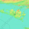
Topografische Karte Sheguiandah
Klicken Sie auf die Karte, um die Höhe anzuzeigen.
Über diese Karte

Name: Topografische Karte Sheguiandah, Höhe, Relief.
Durchschnittliche Höhe: 217 m
Minimale Höhe: 175 m
Maximale Höhe: 263 m
Andere topografische Karten
Klicken Sie auf eine Karte, um ihre Topografie, ihre Höhe und ihr Relief anzuzeigen.

Misery Bay Provincial Park
Canada > Ontario > Manitoulin District > Unorganized West Manitoulin
Durchschnittliche Höhe: 185 m


Barrie Island
Canada > Ontario > Manitoulin District > Gordon/Barrie Island
Durchschnittliche Höhe: 184 m


Fitzwilliam Island
Canada > Ontario > Manitoulin District > Northeastern Manitoulin and the Islands
Durchschnittliche Höhe: 183 m


Lake Manitou
Canada > Ontario > Manitoulin District > Central Manitoulin
Durchschnittliche Höhe: 234 m

Northeastern Manitoulin and the Islands
Canada > Ontario > Manitoulin District
Durchschnittliche Höhe: 192 m