
Spenden
Rüste dich für dein nächstes Abenteuer:
Als Amazon-Partner verdient diese Seite an qualifizierten Käufen, ohne dass Ihnen zusätzliche Kosten entstehen.
Topografische Karte Fraser River
Klicken Sie auf die Karte, um die Höhe anzuzeigen.
Spenden
Rüste dich für dein nächstes Abenteuer:
Als Amazon-Partner verdient diese Seite an qualifizierten Käufen, ohne dass Ihnen zusätzliche Kosten entstehen.
Fraser River
Similar to the Columbia River Gorge east of Portland, Oregon, the Fraser exploits a topographic cleft between two mountain ranges separating a more continental climate (in this case, that of the British Columbia Interior) from a milder climate near the coast. When an Arctic high-pressure area moves into the British Columbia Interior and a relatively low-pressure area builds over the general Puget Sound and Strait of Georgia region, the cold Arctic air accelerates southwest through the Fraser Canyon. These outflow winds can gust up to 97 to 129 kilometres per hour (60 to 80 mph) and have at times exceeded 160 kilometres per hour (100 mph). Such winds frequently reach Bellingham and the San Juan Islands, gaining strength over the open water of the Strait of Juan de Fuca.
Spenden
Rüste dich für dein nächstes Abenteuer:
Als Amazon-Partner verdient diese Seite an qualifizierten Käufen, ohne dass Ihnen zusätzliche Kosten entstehen.
Über diese Karte
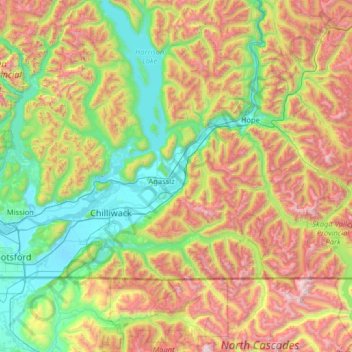
Name: Topografische Karte Fraser River, Höhe, Relief.
Durchschnittliche Höhe: 865 m
Minimale Höhe: -1 m
Maximale Höhe: 2’690 m
Spenden
Rüste dich für dein nächstes Abenteuer:
Als Amazon-Partner verdient diese Seite an qualifizierten Käufen, ohne dass Ihnen zusätzliche Kosten entstehen.