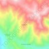
Topografische Karte Sausa
Klicken Sie auf die Karte, um die Höhe anzuzeigen.
Über diese Karte

Name: Topografische Karte Sausa, Höhe, Relief.
Ort: Sausa, Province of Jauja, Junín, Peru (-11.80166 -75.50241 -11.78407 -75.46340)
Durchschnittliche Höhe: 3’390 m
Minimale Höhe: 3’339 m
Maximale Höhe: 3’590 m
Andere topografische Karten
Klicken Sie auf eine Karte, um ihre Topografie, ihre Höhe und ihr Relief anzuzeigen.
Huancayo
Huancayo (Spanish pronunciation: [waŋˈkaʝo]; in Wanka Quechua: Wankayu, '(place) with a (sacred) rock', Quechua pronunciation: [waŋˈkajuː]) is the capital of the Junín Region and Huancayo Province, in the central highlands of Peru, in the Mantaro Valley and is crossed by the Shullcas, Chilca and Mantaro…
Durchschnittliche Höhe: 3’818 m