
Topografische Karte Fish Creek
Interaktive Karte
Klicken Sie auf die Karte, um die Höhe anzuzeigen.
Über diese Karte
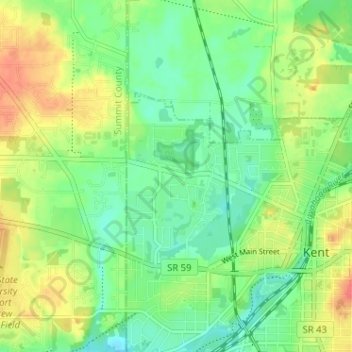
Name: Topografische Karte Fish Creek, Höhe, Relief.
Durchschnittliche Höhe: 325 m
Minimale Höhe: 304 m
Maximale Höhe: 355 m
Andere topografische Karten
Klicken Sie auf eine Karte, um ihre Topografie, ihre Höhe und ihr Relief anzuzeigen.
Brecksville
United States of America > Ohio > Brecksville > Brecksville
Brecksville, Cuyahoga County, Ohio, 44141, United States of America
Durchschnittliche Höhe: 292 m
Allen County
United States of America > Ohio
Allen County, Ohio, United States of America
Durchschnittliche Höhe: 264 m
Scioto County
United States of America > Ohio
Scioto County, Ohio, United States of America
Durchschnittliche Höhe: 245 m
Summerland Beach
United States of America > Ohio > Millersport > Summerland Beach
Summerland Beach, Millersport, Fairfield, Ohio, 43046, United States of America
Durchschnittliche Höhe: 279 m
Gordon
United States of America > Ohio > Gordon
Gordon, Darke County, Ohio, United States of America
Durchschnittliche Höhe: 317 m
Pines Cottage Area
United States of America > Ohio > Pines Cottage Area
Pines Cottage Area, Orange Township, Carroll County, Ohio, 44639, United States of America
Durchschnittliche Höhe: 320 m
Crystal Park
United States of America > Ohio > Canton > Crystal Park
Crystal Park, Canton, Stark County, Ohio, 44705, United States of America
Durchschnittliche Höhe: 331 m
Graytown
United States of America > Ohio > Graytown
Graytown, Benton Township, Ottawa County, Ohio, 43432, United States of America
Durchschnittliche Höhe: 182 m
Norwood
United States of America > Ohio > Norwood
Norwood, Hamilton County, Ohio, United States of America
Durchschnittliche Höhe: 196 m
New Miami
United States of America > Ohio > New Miami > New Miami
New Miami, St. Clair Township, Butler County, Ohio, United States of America
Durchschnittliche Höhe: 188 m
Toledo
United States of America > Ohio > Toledo
Toledo, Lucas County, Ohio, United States of America
Durchschnittliche Höhe: 185 m