Topografische Karten Quebec
Klicken Sie auf eine Karte, um ihre Topografie, ihre Höhe und ihr Relief anzuzeigen.
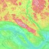

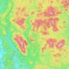
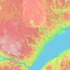

Lanaudière
The region of Lanaudière is part of central Quebec and is located between the Saint Lawrence River and the Laurentian Mountains, between Mauricie and the Laurentides. Lanaudière attracts a good deal of interest from vacationers due to its unique character founded largely on the harmony between its culture…
Durchschnittliche Höhe: 332 m
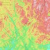

Forêt Montmorency
Canada > Quebec > La Côte-de-Beaupré > Lac-Jacques-Cartier
Located in the Laurentian Mountains, the Montmorency forest is drained by the Montmorency River and by one of its tributaries, the Black river. There are four lakes: Lac Piché, Bédard, Laflamme and Joncas. The altitude varies between 600 and 1,000 meters (3,300 ft) with an average of 750 meters. The…
Durchschnittliche Höhe: 794 m



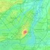
Pierrefonds-Roxboro
Canada > Quebec > Urban agglomeration of Montreal > Montreal
Durchschnittliche Höhe: 30 m


















Bas-Saint-Laurent
The topography of Bas-Saint-Laurent has two main elements : the plateaus of the Appalachian Mountains, called Notre Dame Mountains, and the lowlands in the fine stripe of land along the Saint Lawrence river. These are separated by an intermediate area of ridges and foothills which meld with the plateaus. The…
Durchschnittliche Höhe: 285 m




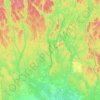
Rivière aux Rats
Canada > Quebec > Maria-Chapdelaine > Rivière-Mistassini
Durchschnittliche Höhe: 248 m

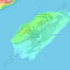
Île de la Grande Entrée
Canada > Quebec > Urban agglomeration of Les Îles-de-la-Madeleine > Les Îles-de-la-Madeleine > Grande-Entrée
Durchschnittliche Höhe: 2 m




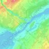
Paradis-des-Chênes
Canada > Quebec > Brome-Missisquoi > Dunham > Paradis-des-Chênes
Durchschnittliche Höhe: 167 m

Îles Saint-Jean-Baptiste
Canada > Quebec > La Vallée-de-la-Gatineau > Sainte-Thérèse-de-la-Gatineau
Durchschnittliche Höhe: 247 m


Mount Royal Park
Canada > Quebec > Urban agglomeration of Montreal > Montreal
The mountain is part of the Monteregian Hills situated between the Laurentians and the Appalachian Mountains. It gave its Latin name, Mons Regius, to the Monteregian chain. The mountain consists of three peaks: Colline de la Croix (or Mont Royal proper) at 233 m (764 ft), Colline d'Outremont (or Mount Murray,…
Durchschnittliche Höhe: 110 m
Lac-à-la-Truite
Canada > Quebec > Les Laurentides > Sainte-Agathe-des-Monts
Durchschnittliche Höhe: 408 m