

Topografische Karten Prince George's County
Klicken Sie auf eine Karte, um ihre Topografie, ihre Höhe und ihr Relief anzuzeigen.
The Village
United States > Maryland > Prince George's County > Brandywine
Durchschnittliche Höhe: 68 m

White Hall Terrace
United States > Maryland > Prince George's County > Accokeek
Durchschnittliche Höhe: 59 m
Andrews Manor
United States > Maryland > Prince George's County > Camp Springs
Durchschnittliche Höhe: 79 m

Chestnut Hills
United States > Maryland > Prince George's County > Beltsville
Durchschnittliche Höhe: 47 m
Upper Marlboro
United States > Maryland > Prince George's County > Upper Marlboro > Upper Marlboro
Durchschnittliche Höhe: 27 m
Hyattsville
United States > Maryland > Prince George's County
Downtown Hyattsville underwent revitalization in the early 2000s with the development of Arts District Hyattsville, part of the Gateway Arts District, a private project which includes townhomes, live-work units, and retail space. The master developer of the 25-acre neighborhood was Bethesda-based EYA, and was…
Durchschnittliche Höhe: 61 m
Seabrook Acres
United States > Maryland > Prince George's County > Seabrook > Seabrook Acres
Durchschnittliche Höhe: 50 m
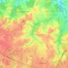
District Heights
United States > Maryland > Prince George's County > District Heights > District Heights
Durchschnittliche Höhe: 73 m
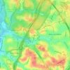
Wildercroft
United States > Maryland > Prince George's County > East Riverdale
Durchschnittliche Höhe: 39 m
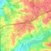
Phelps Corner
United States > Maryland > Prince George's County > Oxon Hill
Durchschnittliche Höhe: 58 m

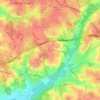
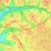
Auth Village
United States > Maryland > Prince George's County > Camp Springs
Durchschnittliche Höhe: 77 m
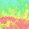
Greater Capitol Heights
United States > Maryland > Prince George's County > Maryland Park > Greater Capitol Heights
Durchschnittliche Höhe: 59 m
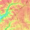
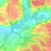
Piscataway
United States > Maryland > Prince George's County > Fort Washington
Durchschnittliche Höhe: 36 m
Lake Artemesia
United States > Maryland > Prince George's County > College Park
Durchschnittliche Höhe: 26 m
Mount Rainier Community Food Forest
United States > Maryland > Prince George's County > Mount Rainier
Durchschnittliche Höhe: 23 m


Beltsville
United States > Maryland > Prince George's County > Beltsville
Durchschnittliche Höhe: 61 m


Rosaryville State Park
United States > Maryland > Prince George's County > Upper Marlboro
Durchschnittliche Höhe: 59 m


Camp Springs
United States > Maryland > Prince George's County > Camp Springs
Durchschnittliche Höhe: 72 m