

Topografische Karten Boring
Klicken Sie auf eine Karte, um ihre Topografie, ihre Höhe und ihr Relief anzuzeigen.
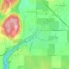
Boring
United States of America > Oregon > Boring
Boring's landscape is hilly, with its elevation ranging between 548 feet (167 m) and 755 feet (230 m). Several creeks run west through the community limits into the Clackamas River, including Doane Creek, North Fork Deep Creek, and Tickle Creek.
Durchschnittliche Höhe: 183 m