Geolokalisieren

Topografische Karten Irland

Klicken Sie auf eine Karte, um ihre Topografie, ihre Höhe und ihr Relief anzuzeigen.

Cock Island

Irland > County Cavan

Durchschnittliche Höhe: 90 m

Ballyjamesduff Municipal District

Irland > County Cavan

Durchschnittliche Höhe: 100 m

Inishbofin Civil Parish

Irland > County Galway

Inishbofin (irisch Inis Bó Finne – „Insel der weißen Kuh“) ist eine kleine Insel 9 km vor der Westküste der Republik Irland im County Galway. Die 15 km² große stark gegliederte Insel liegt vor Connemara nördlich der Stadt Clifden. Sie erreicht eine Höhe von 85 Metern im Westen und weist zwei…

Durchschnittliche Höhe: 2 m

Lacken

Irland > County Wicklow

Durchschnittliche Höhe: 266 m

Cork

Irland > County Cork

Durchschnittliche Höhe: 80 m

Cape Clear

Irland > County Cork

Durchschnittliche Höhe: 10 m

Cliffs of Moher

Irland > County Clare

Die Klippen ragen an vielen Stellen nahezu senkrecht aus dem atlantischen Ozean und erstrecken sich über mehr als acht Kilometer. Am Südende, dem Hag’s Head, haben sie eine Höhe von ungefähr 120 m, nördlich des O’Brien’s Tower erreichen sie sogar 214 m.

Durchschnittliche Höhe: 55 m
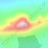
Croagh Patrick

Irland > County Mayo

Durchschnittliche Höhe: 314 m

Waterville

Irland > County Kerry

Durchschnittliche Höhe: 15 m

Island

Irland > County Cavan

Durchschnittliche Höhe: 122 m

Kilkenny

Irland > County Kilkenny

Durchschnittliche Höhe: 63 m

Lear

Irland > County Cavan

Durchschnittliche Höhe: 189 m

Drogheda

Irland > County Louth

Durchschnittliche Höhe: 34 m

Galway

Irland > County Galway

Durchschnittliche Höhe: 16 m

Doolin

Irland > County Clare > Doolin

Durchschnittliche Höhe: 38 m

County Kerry

Irland

Die Corcu Duibne hatten auch beeindruckende architektonische Fähigkeiten. Sie bauten die spektakulären Promontory Forts Caherconree und Dunbeg Fort. Die Milesier waren die dritte Gruppe, die sich in der Region ansiedelte. Nach der Legende sollen sie Irland etwa 100 v. Chr. erobert haben. Die letzte…

Durchschnittliche Höhe: 123 m

Dublin

Irland > County Dublin

Durchschnittliche Höhe: 42 m

Rossnaree

Irland > County Meath

Durchschnittliche Höhe: 42 m

Stripes

Irland > County Kilkenny

Durchschnittliche Höhe: 33 m

Scarriff

Irland > County Clare > Scarriff

Durchschnittliche Höhe: 52 m

Slieve Elva

Irland > County Clare

Durchschnittliche Höhe: 256 m

Leinster

Irland

Durchschnittliche Höhe: 78 m

Ballynacarriga

Irland > County Mayo

Durchschnittliche Höhe: 47 m

Inishowen

Irland > County Donegal

Durchschnittliche Höhe: 13 m

Dundalk

Irland > County Louth

Durchschnittliche Höhe: 14 m

Glaslough

Irland > County Monaghan

Durchschnittliche Höhe: 49 m

Meelin

Irland > County Cork

Durchschnittliche Höhe: 246 m

Mamore Gap

Irland > County Donegal

Durchschnittliche Höhe: 192 m

Intrinsic Bay

Irland

Durchschnittliche Höhe: 18 m

Burren

Irland > County Mayo

Durchschnittliche Höhe: 213 m

Strade

Irland > County Mayo

Durchschnittliche Höhe: 22 m

County Cavan

Irland

Durchschnittliche Höhe: 106 m

County Mayo

Irland

Durchschnittliche Höhe: 66 m

Hen Island

Irland > County Galway

Durchschnittliche Höhe: 0 m

Corclare

Irland > County Cavan

Durchschnittliche Höhe: 115 m

Johnstown

Irland > County Kilkenny

Durchschnittliche Höhe: 129 m

Greenfort Island

Irland > County Donegal

Durchschnittliche Höhe: 23 m

Municipal District of Carrigaline

Irland > County Cork

Durchschnittliche Höhe: 52 m

Valentia

Irland > County Kerry

Eine Ringstraße erschließt die Insel. Während die südliche, die R565, die Verkehre aufnimmt, führt die nördliche, höher gelegene zu den Vorzeitdenkmälern (Menhire, Oghamsteinen und Wedge Tombs). Abzweige zur West- und Nordküste führen zu weiteren Plätzen.

Durchschnittliche Höhe: 39 m
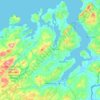
Letterkenny Municipal District

Irland > County Donegal

Durchschnittliche Höhe: 92 m

Dunshaughlin

Irland > County Meath

Durchschnittliche Höhe: 101 m

Cashel

Irland > County Tipperary

Durchschnittliche Höhe: 115 m

Slane

Irland > County Meath

Durchschnittliche Höhe: 66 m

Roundwood

Irland > County Wicklow

Roundwood, historisch auch als Togher bekannt, befindet sich am Kreuzungspunkt der Regionalstraßen R755, R764 und R765. Die R755 ist die Hauptverkehrsstrecke von Dublin in das südlich gelegene Glendalough in den Wicklow Mountains. Mit einer Seehöhe von 238 m ist Roundwood eines der höchstgelegenen Dörfer…

Durchschnittliche Höhe: 242 m
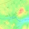
Gowran

Irland > County Kilkenny

Durchschnittliche Höhe: 64 m

Tallaght

Irland > County Dublin

Durchschnittliche Höhe: 121 m

Craan

Irland > County Carlow

Durchschnittliche Höhe: 94 m

Gleann a Ruid

Irland > County Galway

Durchschnittliche Höhe: 133 m

Conamara Municipal District

Irland > County Galway

Durchschnittliche Höhe: 51 m

Huntstown

Irland > County Dublin

Durchschnittliche Höhe: 81 m

Clare Island

Irland > County Mayo

Durchschnittliche Höhe: 29 m

Islands

Irland > County Clare

Durchschnittliche Höhe: 64 m

Árainn Mhór

Irland > County Donegal

Durchschnittliche Höhe: 50 m

Ballymote

Irland > County Sligo

Durchschnittliche Höhe: 77 m

Cavan

Irland > County Cavan

Durchschnittliche Höhe: 86 m

Quilty

Irland > County Clare

Durchschnittliche Höhe: 13 m

Knockanteedan

Irland > County Dublin

Durchschnittliche Höhe: 243 m

Glencolumbkille

Irland > County Donegal

Es ist eine etwa zwei Meter tiefe Röhre, die aber aufgrund fehlender Tritt- und Haltemöglichkeiten nicht benutzt werden kann. Von der früheren Erforschung ist bekannt, dass die Röhre neben einem rechteckigen, über sechs Meter langen, etwa 2,5 Meter breiten und 1,6 m hohen Raum endet, in den man durch…

Durchschnittliche Höhe: 95 m

Killaloe Municipal District

Irland > County Clare

Durchschnittliche Höhe: 85 m

Rush

Irland > County Dublin

Durchschnittliche Höhe: 7 m

Lusk

Irland > County Dublin

Durchschnittliche Höhe: 23 m

Dunmore East

Irland > County Waterford

Das Passage tomb von Harristown liegt an der Ostseite einer Anhöhe, die als "Carrick a Dhirra" bekannt ist, etwa 3,9 km von Dunmore East. Die Gründung der Stadt Dunmore East ist ungeklärt. 1640 ließ Lord Power of Curraghmore, der viele Besitztümer in der Gegend hatte, auf den Klippen oberhalb des kleinen…

Durchschnittliche Höhe: 36 m
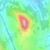
Little Sugar Loaf

Irland > County Wicklow

Durchschnittliche Höhe: 131 m

Ballykeeran

Irland > County Westmeath

Durchschnittliche Höhe: 47 m

Fingal

Irland > County Dublin

Durchschnittliche Höhe: 39 m

Ballymahon

Irland > County Meath

Durchschnittliche Höhe: 66 m

Glenties Municipal District

Irland > County Donegal

Durchschnittliche Höhe: 90 m

County Carlow

Irland

Durchschnittliche Höhe: 126 m

Ennis Municipal District

Irland > County Clare

Durchschnittliche Höhe: 39 m

West Cork

Irland > County Cork

Durchschnittliche Höhe: 83 m

Über diesen Ort

 •  •  •  •  •  •  •  •  •  •  •  •  •  •  •  •  •

Rüste dich für dein nächstes Abenteuer:

🛶Wasserdichte Taschen - Schützt Ausrüstung bei Regen und Wasseraktivitäten
🔥Feuerstahl - Zuverlässiges Feuermachen bei jedem Wetter
👕Funktionsshirts fürs Wandern - Atmungsaktive Shirts für aktive Outdoor‑Touren
🌦️Regenjacken für Wanderer - Wasserdichte Jacken für wechselhaftes Wetter
🛏️Isomatten & Schlafunterlagen - Komfortable Unterlagen für erholsamen Schlaf

Als Amazon-Partner verdient diese Seite an qualifizierten Käufen, ohne dass Ihnen zusätzliche Kosten entstehen.