
Topografische Karte Tai Tapu
Interaktive Karte
Klicken Sie auf die Karte, um die Höhe anzuzeigen.
Über diese Karte
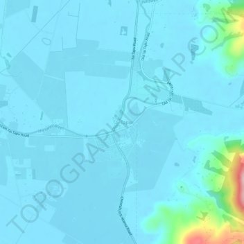
Name: Topografische Karte Tai Tapu, Höhe, Relief.
Ort: Tai Tapu, Selwyn District, Canterbury, 7672, New Zealand (-43.67960 172.53023 -43.63960 172.57023)
Durchschnittliche Höhe: 21 m
Minimale Höhe: 4 m
Maximale Höhe: 216 m
Andere topografische Karten
Klicken Sie auf eine Karte, um ihre Topografie, ihre Höhe und ihr Relief anzuzeigen.
Springfield
New Zealand > Canterbury > Selwyn District
Springfield, Selwyn District, Canterbury, 7649, New Zealand
Durchschnittliche Höhe: 396 m
Prebbleton
New Zealand > Canterbury > Selwyn District
Prebbleton, Selwyn District, Canterbury, 7604, New Zealand
Durchschnittliche Höhe: 25 m
Windwhistle
New Zealand > Canterbury > Selwyn District
Windwhistle, Selwyn District, Canterbury, New Zealand
Durchschnittliche Höhe: 434 m
Rolleston
New Zealand > Canterbury > Selwyn District
Rolleston, Selwyn District, Canterbury, 7643, New Zealand
Durchschnittliche Höhe: 54 m
Castle Hill Village
New Zealand > Canterbury > Selwyn District
Castle Hill Village, Selwyn District, Canterbury, 7580, New Zealand
Durchschnittliche Höhe: 787 m
Lincoln
New Zealand > Canterbury > Selwyn District
Lincoln, Selwyn District, Canterbury, 7608, New Zealand
Durchschnittliche Höhe: 15 m
West Melton
New Zealand > Canterbury > Selwyn District
West Melton, Selwyn District, Canterbury, 7618, New Zealand
Durchschnittliche Höhe: 88 m
Sheffield
New Zealand > Canterbury > Selwyn District
Sheffield, Selwyn District, Canterbury, 7500, New Zealand
Durchschnittliche Höhe: 309 m
Dunsandel
New Zealand > Canterbury > Selwyn District
Dunsandel, Selwyn District, Canterbury, 7682, New Zealand
Durchschnittliche Höhe: 74 m
Arthur's Pass
New Zealand > Canterbury > Selwyn District
Arthur's Pass, Selwyn District, Canterbury, 7875, New Zealand
Durchschnittliche Höhe: 1’204 m
Darfield
New Zealand > Canterbury > Selwyn District
Darfield, Selwyn District, Canterbury, 7510, New Zealand
Durchschnittliche Höhe: 202 m
Rakaia River
New Zealand > Canterbury > Selwyn District
Rakaia River, Selwyn District, Canterbury, New Zealand
Durchschnittliche Höhe: 52 m
Selwyn
New Zealand > Canterbury > Selwyn District
Selwyn, Selwyn District, Canterbury, 7682, New Zealand
Durchschnittliche Höhe: 70 m
Castle Hill Peak
New Zealand > Canterbury > Selwyn District
Castle Hill Peak, Selwyn District, Canterbury, New Zealand
Durchschnittliche Höhe: 1’512 m
Leeston
New Zealand > Canterbury > Selwyn District
Leeston, Selwyn District, Canterbury, 7632, New Zealand
Durchschnittliche Höhe: 22 m
Te Hāpua Waikawa / Lake Lyndon
New Zealand > Canterbury > Selwyn District
Te Hāpua Waikawa / Lake Lyndon, Selwyn District, Canterbury, New Zealand
Durchschnittliche Höhe: 1’012 m
Kirwee
New Zealand > Canterbury > Selwyn District
Kirwee, Selwyn District, Canterbury, New Zealand
Durchschnittliche Höhe: 158 m