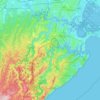
Topografische Karte Echo Point
Klicken Sie auf die Karte, um die Höhe anzuzeigen.
Über diese Karte

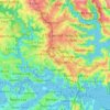
Name: Topografische Karte Echo Point, Höhe, Relief.
Ort: Echo Point, Sydney, New South Wales, 2780, Australia (-33.74224 150.30217 -33.72224 150.32217)
Durchschnittliche Höhe: 725 m
Minimale Höhe: 323 m
Maximale Höhe: 1’013 m
Andere topografische Karten
Klicken Sie auf eine Karte, um ihre Topografie, ihre Höhe und ihr Relief anzuzeigen.
Penrith
Australia > New South Wales > Sydney > Penrith
Penrith is a city in New South Wales, Australia, located in Greater Western Sydney, 55 kilometres (31 mi) west of the Sydney central business district on the banks of the Nepean River, on the outskirts of the Cumberland Plain. Its elevation is 32 metres (105 ft).
Durchschnittliche Höhe: 34 m










Lane Cove National Park
Australia > New South Wales > Sydney
The park includes areas of land which are part of Ku-ring-gai, Ryde, and Hornsby local government areas with small areas of the park in Willoughby, Lane Cove and Hunter's Hill local government areas on the banks of the lower reaches of the river. The park is surrounded on all sides by developed suburban areas…
Durchschnittliche Höhe: 81 m






Wentworth Falls
Australia > New South Wales > Sydney
Wentworth Falls (postcode: 2782) is a town in the Blue Mountains region of New South Wales, situated approximately 100 kilometres (62 mi) west of the Sydney central business district, and about 8 kilometres (5.0 mi) east of Katoomba, Australia on the Great Western Highway, with a Wentworth Falls railway…
Durchschnittliche Höhe: 708 m

Sydney International Regatta Centre
Australia > New South Wales > Sydney > Penrith
Durchschnittliche Höhe: 19 m




Berowra
Australia > New South Wales > Sydney
Berowra is located 44 kilometres north of the Sydney CBD and lies at an altitude of 215 metres. Surrounded by bushland, it borders the national parks of both the Berowra Valley and Ku-ring-gai Chase.
Durchschnittliche Höhe: 144 m