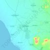
Topografische Karte Lima
Klicken Sie auf die Karte, um die Höhe anzuzeigen.
Über diese Karte

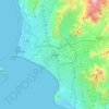
Name: Topografische Karte Lima, Höhe, Relief.
Ort: Lima, Peru (-13.32417 -77.88631 -10.27419 -75.50750)
Durchschnittliche Höhe: 2’425 m
Minimale Höhe: -3 m
Maximale Höhe: 5’965 m
Andere topografische Karten
Klicken Sie auf eine Karte, um ihre Topografie, ihre Höhe und ihr Relief anzuzeigen.

Machu Picchu
Peru > Cusco > Machupicchu > San Miguel
Animals are also suspected to have immigrated to Machu Picchu as there were several bones found that were not native to the area. Most animal bones found were from llamas and alpacas. These animals naturally live at altitudes of 4,000 metres (13,000 ft) rather than the 2,400 metres (7,900 ft) elevation of…
Durchschnittliche Höhe: 2’227 m
Cuzco
Cusco is the seventh-most populous city in Peru; in 2017, it had a population of 428,450. It is also the largest city in the Peruvian Andes and the region is the seventh-most populous metropolitan area of Peru. Its elevation is around 3,400 m (11,200 ft). The largest district in the city is the Cusco District,…
Durchschnittliche Höhe: 3’790 m
Ausangate
Ausangate or Auzangate (in Hispanicized spellings) is a mountain of the Vilcanota mountain range in the Andes of Peru. With an elevation of 6,384 metres, it is situated around 100 kilometres southeast of Cusco in the Cusco Region, Canchis Province, Pitumarca District, and in the Quispicanchi Province, Ocongate…
Durchschnittliche Höhe: 5’617 m


Huaraz
Huaraz ([waˈɾas]) (from Quechua: Waraq or Warash, "dawn"), formerly designated as San Sebastián de Huaraz, is a city in Peru. It is the capital of the Ancash Region (State of Ancash) and the seat of government of Huaraz Province. The urban area's population is distributed over the districts of Huaraz and…
Durchschnittliche Höhe: 4’068 m

Colca Canyon
Peru > Arequipa > Cabanaconde
In May 1981, the Polish Canoandes rafting expedition, led by Andrzej Pietowski, made the first descent of the river below Cabanaconde and proclaimed the possibility of its being the world's deepest canyon. It was so recognized by the Guinness Book of Records in 1984, and a National Geographic article in…
Durchschnittliche Höhe: 3’169 m


Huascarán Sur
Huascarán (Spanish pronunciation: [waskaˈɾan], wass-ka-RAHN; Quechua: Waskaran), Nevado Huascarán or Mataraju is a mountain located in Yungay Province, Ancash Department, Peru. It is situated in the Cordillera Blanca range of the western Andes. The southern summit of Huascarán (Huascarán Sur), which…
Durchschnittliche Höhe: 6’009 m

Trujillo
Trujillo is located at an altitude of 34 metres (112 feet) on a coastal strip in the west of the province of Trujillo, in the old valley of Chimor today known as the Moche or Santa Catalina Valley. Its main square is located at 8°6′3″S 79°1′34″W / 8.10083°S 79.02611°W / -8.10083; -79.02611…
Durchschnittliche Höhe: 213 m


Huaraz
Huaraz ([waˈɾas]) (from Quechua: Waraq or Warash, "dawn"), formerly designated as San Sebastián de Huaraz, is a city in Peru. It is the capital of the Ancash Region (State of Ancash) and the seat of government of Huaraz Province. The urban area's population is distributed over the districts of Huaraz and…
Durchschnittliche Höhe: 4’068 m

Pisac
The town is located in the district of Pisac, in the province of Calca, at the southern end of the Sacred Valley at an altitude of 2,972 metres (9,751 ft), 32 kilometres (20 mi) northeast of Cusco. The town straddles the Vilcanota River, with most of the settlement on its right bank, where it is laid out in a…
Durchschnittliche Höhe: 3’520 m

Huancayo
Huancayo (Spanish pronunciation: [waŋˈkaʝo]; in Wanka Quechua: Wankayu, '(place) with a (sacred) rock', Quechua pronunciation: [waŋˈkajuː]) is the capital of the Junín Region and Huancayo Province, in the central highlands of Peru, in the Mantaro Valley and is crossed by the Shullcas, Chilca and Mantaro…
Durchschnittliche Höhe: 3’818 m
Sacsayhuamán
Peru > Cusco > Cuzco > Mollococha
Sacsayhuamán (/ˈsæksaɪˌwʌmən/ SACK-sy-wuh-mən; Spanish pronunciation: [saksajwaˈman]) or Saksaywaman (from Quechua Saksay waman pukara, pronounced [ˈsaksaj ˈwaman], lit. 'fortress of the royal falcon or hawk') is a citadel on the northern outskirts of the city of Cusco, Peru, the historic capital…
Durchschnittliche Höhe: 3’578 m




Lima
The suburban district of Cieneguilla, the district of Pachacámac and the district of Chosica provide important tourist attractions among locals. Due to its elevation (over 500 masl), the sun shines in Chosica during the winter, being very visited by the residents of Lima to escape the urban fog.
Durchschnittliche Höhe: 236 m
La Bella Durmiente
La Bella Durmiente (Spanish for Sleeping Beauty), also known as Puma Ringri (possibly from Quechua puma cougar, puma, rinri ear, "puma ear"), is a mountain and prominent feature of Tingo María National Park, in the region of Huánuco, Peru. It is located in the district of Mariano Damaso, Leoncio Prado…
Durchschnittliche Höhe: 877 m


Abancay
Abancay is located at an elevation of 2,377 metres (7,799 ft) above sea level in the southern Peruvian Andes, above the Pachachaca River, and straddles the Marino River. Because of its dry mountain and famous year-round warm weather it is known as "The Eternal Springtime Valley". The nearest cities are Cusco,…
Durchschnittliche Höhe: 3’400 m
Abancay
Abancay is located at an elevation of 2,377 metres (7,799 ft) above sea level in the southern Peruvian Andes, above the Pachachaca River, and straddles the Marino River. Because of its dry mountain and famous year-round warm weather it is known as "The Eternal Springtime Valley". The nearest cities are Cusco,…
Durchschnittliche Höhe: 3’400 m
Lima
The suburban district of Cieneguilla, the district of Pachacámac and the district of Chosica provide important tourist attractions among locals. Due to its elevation (over 500 masl), the sun shines in Chosica during the winter, being very visited by the residents of Lima to escape the urban fog.
Durchschnittliche Höhe: 236 m
Vinicunca
Vinicunca, or Winikunka, also called Montaña de Siete Colores (literally: Mountain of seven colors), Montaña de Colores (Mountain of colors) or Montaña Arcoíris (Rainbow Mountain), is a mountain in the Andes of Peru with an altitude of 5,200 metres (17,100 ft) above sea level. It is located on the road to…
Durchschnittliche Höhe: 4’874 m
La Rinconada
High in the Andes, La Rinconada has an alpine tundra climate (ET, according to the Köppen climate classification), with no month having mean temperatures even close to the 10 °C (50 °F) threshold that would permit tree growth and a subtropical highland classification for the city. Far above the tree line,…
Durchschnittliche Höhe: 4’923 m


Huaraz
Huaraz ([waˈɾas]) (from Quechua: Waraq or Warash, "dawn"), formerly designated as San Sebastián de Huaraz, is a city in Peru. It is the capital of the Ancash Region (State of Ancash) and the seat of government of Huaraz Province. The urban area's population is distributed over the districts of Huaraz and…
Durchschnittliche Höhe: 4’068 m
Trujillo
Trujillo is located at an altitude of 34 metres (112 feet) on a coastal strip in the west of the province of Trujillo, in the old valley of Chimor today known as the Moche or Santa Catalina Valley. Its main square is located at 8°6′3″S 79°1′34″W / 8.10083°S 79.02611°W / -8.10083; -79.02611…
Durchschnittliche Höhe: 213 m
Cuzco
Cusco is the seventh-most populous city in Peru; in 2017, it had a population of 428,450. It is also the largest city in the Peruvian Andes and the region is the seventh-most populous metropolitan area of Peru. Its elevation is around 3,400 m (11,200 ft). The largest district in the city is the Cusco District,…
Durchschnittliche Höhe: 3’790 m




La Rinconada
The town has gained notoriety for its extreme living conditions that include its high rates of altitude sickness, pollution, poverty, murder, and sex trafficking, and as a result has sometimes been referred to in Spanish as la ciudad sin ley del Perú, which means "the lawless city of Peru".
Durchschnittliche Höhe: 4’923 m

Sacsayhuamán
Peru > Cusco > Cuzco > Mollococha
Sacsayhuamán (/ˈsæksaɪˌwʌmən/ SACK-sy-wuh-mən; Spanish pronunciation: [saksajwaˈman]) or Saksaywaman (from Quechua Saksay waman pukara, pronounced [ˈsaksaj ˈwaman], lit. 'fortress of the royal falcon or hawk') is a citadel on the northern outskirts of the city of Cusco, Peru, the historic capital…
Durchschnittliche Höhe: 3’578 m



Nevado Salkantay
Salcantay, Salkantay or Sallqantay (in Quechua) is the highest peak in the Vilcabamba mountain range, part of the Peruvian Andes. It is located in the Cusco Region, about 60 km (40 mi) west-northwest of the city of Cusco. It is the 38th-highest peak in the Andes and the twelfth-highest in Peru. However, as a…
Durchschnittliche Höhe: 5’266 m

Cerro de Pasco
Cerro de Pasco is a city in central Peru, located at the top of the Andean Mountains. It is the capital of both the Pasco Province and the Department of Pasco, and an important mining center of silver, copper, zinc and lead. At an elevation of 4,330 metres (14,210 ft), it is one of the highest cities in the…
Durchschnittliche Höhe: 4’239 m





Vinicunca
Vinicunca, or Winikunka, also called Montaña de Siete Colores (literally: Mountain of seven colors), Montaña de Colores (Mountain of colors) or Montaña Arcoíris (Rainbow Mountain), is a mountain in the Andes of Peru with an altitude of 5,200 metres (17,100 ft) above sea level. It is located on the road to…
Durchschnittliche Höhe: 4’874 m
Vinicunca
Vinicunca, or Winikunka, also called Montaña de Siete Colores (literally: Mountain of seven colors), Montaña de Colores (Mountain of colors) or Montaña Arcoíris (Rainbow Mountain), is a mountain in the Andes of Peru with an altitude of 5,036 metres (16,522 ft) above sea level. It is located on the road to…
Durchschnittliche Höhe: 4’874 m


Cerro de Pasco
Cerro de Pasco is a city in central Peru, located at the top of the Andean Mountains. It is the capital of both the Pasco Province and the Department of Pasco, and an important mining center of silver, copper, zinc and lead. At an elevation of 4,330 metres (14,210 ft), it is one of the highest cities in the…
Durchschnittliche Höhe: 4’239 m

Lima
The suburban district of Cieneguilla, the district of Pachacámac and the district of Chosica provide important tourist attractions among locals. Due to its elevation (over 500 masl), the sun shines in Chosica during the winter, being very visited by the residents of Lima to escape the urban fog.
Durchschnittliche Höhe: 236 m


Nevado Mismi
The Upper Amazon expedition (The Flying Expedition) included an Eastern European multi-axled articulated Land Rover for use on land, a float plane Papagaiu, for air support and reconnaissance, and the Peruvian Air Force offered a high elevation helicopter to reach the upper levels of the Chila mountain range…
Durchschnittliche Höhe: 5’273 m