

Topografische Karte Highland
Klicken Sie auf die Karte, um die Höhe anzuzeigen.
Über diese Karte

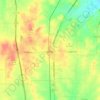
Name: Topografische Karte Highland, Höhe, Relief.
Ort: Highland, Johnson County, Texas, United States (32.15209 -97.56974 32.19209 -97.52974)
Durchschnittliche Höhe: 198 m
Minimale Höhe: 162 m
Maximale Höhe: 250 m
Andere topografische Karten
Klicken Sie auf eine Karte, um ihre Topografie, ihre Höhe und ihr Relief anzuzeigen.
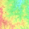
Burleson
United States > Texas > Johnson County
As of 2010, Burleson had a total area of 26.07 square miles (67.52 km2), of which 26.01 square miles (67.36 km2) were land and 0.07 square miles (0.17 km2), or 0.25%, were water. Village Creek, a tributary of the Trinity River, flows to the northeast through the city. Most of Burleson lies between 700 and 800…
Durchschnittliche Höhe: 244 m



Burleson
United States > Texas > Johnson County
As of 2010, Burleson had a total area of 26.07 square miles (67.52 km2), of which 26.01 square miles (67.36 km2) were land and 0.07 square miles (0.17 km2), or 0.25%, were water. Village Creek, a tributary of the Trinity River, flows to the northeast through the city. Most of Burleson lies between 700 and 800…
Durchschnittliche Höhe: 244 m