Topografische Karte Mount Kinabalu
Klicken Sie auf die Karte, um die Höhe anzuzeigen.
Mount Kinabalu
Low's Peak can be climbed by a person in good physical condition without mountaineering equipment on the main route. However, climbers must be accompanied by accredited guides at all times due to national park regulations and the risk of experiencing altitude sickness.
Über diese Karte
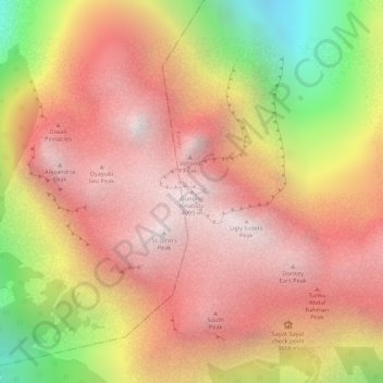
Name: Topografische Karte Mount Kinabalu, Höhe, Relief.
Ort: Mount Kinabalu, Ranau, West Coast Division, Sabah, Malaysia (6.07502 116.55865 6.07512 116.55875)
Durchschnittliche Höhe: 3’567 m
Minimale Höhe: 2’661 m
Maximale Höhe: 4’062 m
Andere topografische Karten
Klicken Sie auf eine Karte, um ihre Topografie, ihre Höhe und ihr Relief anzuzeigen.
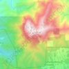
Kinabalu Park
Malaysia > Sabah > Ranau > Tinompok
The park headquarters is 88 kilometres away from the city of Kota Kinabalu. There are sealed roads leading towards the park headquarters from other parts of Sabah. It is situated on the southern boundary of Kinabalu Park, at an elevation of 1,563 m (5,128 ft).
Durchschnittliche Höhe: 2’063 m