Geolokalisieren

Topografische Karte Thompsons

Klicken Sie auf die Karte, um die Höhe anzuzeigen.

Über diese Karte

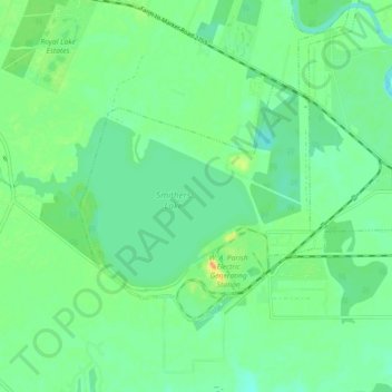
Name: Topografische Karte Thompsons, Höhe, Relief.

Ort: Thompsons, Fort Bend County, Texas, United States (29.46805 -95.66540 29.51732 -95.57537)

Durchschnittliche Höhe: 22 m

Minimale Höhe: 10 m

Maximale Höhe: 45 m

Andere topografische Karten

Klicken Sie auf eine Karte, um ihre Topografie, ihre Höhe und ihr Relief anzuzeigen.

Paynes

United States > Texas > Fort Bend County > Sugar Land

Durchschnittliche Höhe: 24 m

Brazos Bend State Park

United States > Texas > Fort Bend County > Alvin

Brazos Bend State Park occupies land bordering the Brazos River and includes within its boundaries low-lying areas left over from the River's previous meanderings. Pre-Columbian inhabitants included a series of Native American groups, most notably the Karankawa. The land passed through a variety of landowners'…

Durchschnittliche Höhe: 17 m

Guy

United States > Texas > Fort Bend County

Durchschnittliche Höhe: 24 m

Oak Hill

United States > Texas > Fort Bend County

Durchschnittliche Höhe: 29 m

Sienna

United States > Texas > Fort Bend County

Durchschnittliche Höhe: 20 m

Katy

United States > Texas > Fort Bend County > Katy > Katy

Durchschnittliche Höhe: 43 m

Pecan Grove

United States > Texas > Fort Bend County

Durchschnittliche Höhe: 27 m

Fresno

United States > Texas > Fort Bend County

Durchschnittliche Höhe: 21 m

Needville

United States > Texas > Fort Bend County > Needville > Needville

Durchschnittliche Höhe: 27 m

Cumings

United States > Texas > Fort Bend County > Rosenberg

Durchschnittliche Höhe: 29 m

Dewalt

United States > Texas > Fort Bend County > Missouri City

Durchschnittliche Höhe: 22 m

Weston Lakes

United States > Texas > Fort Bend County > Weston Lakes

Durchschnittliche Höhe: 34 m

Richmond

United States > Texas > Fort Bend County > Richmond > Richmond

Durchschnittliche Höhe: 27 m

Trammels

United States > Texas > Fort Bend County > Missouri City > Trammels

Durchschnittliche Höhe: 22 m

Lake D

United States > Texas > Fort Bend County

Durchschnittliche Höhe: 35 m

Duke

United States > Texas > Fort Bend County > Arcola

Durchschnittliche Höhe: 20 m

Rüste dich für dein nächstes Abenteuer:

🍫Energie‑Snacks fürs Wandern - Riegel und Snacks für neue Kraft unterwegs
🛰️GPS-Handgeräte - Präzise Navigation für anspruchsvolle Bergrouten in den Alpen
🦵Gamaschen - Schutz vor Nässe, Matsch und Schnee beim Bergsteigen
🧗Material-Karabiner - Praktische Befestigung für Ausrüstung am Rucksack
🧵Paracord-Schnüre - Vielseitige Leine für Reparaturen und Notfälle

Als Amazon-Partner verdient diese Seite an qualifizierten Käufen, ohne dass Ihnen zusätzliche Kosten entstehen.