Geolokalisieren

Topografische Karte Cedar Key

Interaktive Karte

Klicken Sie auf die Karte, um die Höhe anzuzeigen.

Über diese Karte

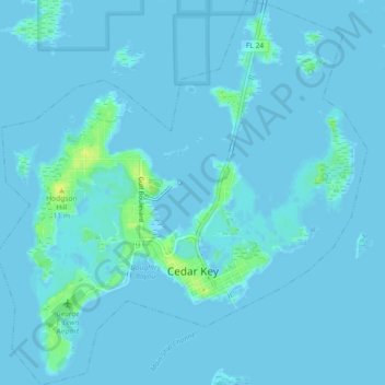
Name: Topografische Karte Cedar Key, Höhe, Relief.

Ort: Cedar Key, Levy County, Florida, United States (29.12591 -83.05917 29.16568 -83.01530)

Durchschnittliche Höhe: 2 m

Minimale Höhe: -2 m

Maximale Höhe: 18 m

Andere topografische Karten

Klicken Sie auf eine Karte, um ihre Topografie, ihre Höhe und ihr Relief anzuzeigen.

Bronson

United States > Florida > Levy County

Bronson, Levy County, Florida, United States

Durchschnittliche Höhe: 21 m

Yankeetown

United States > Florida > Levy County

Yankeetown, Levy County, Florida, 34498, United States

Durchschnittliche Höhe: 6 m

Manatee Springs State Park

United States > Florida > Levy County > Chiefland

Manatee Springs State Park, Chiefland, Levy County, Florida, 32626, United States

Durchschnittliche Höhe: 6 m

Morriston

United States > Florida > Levy County

Morriston, Levy County, Florida, United States

Durchschnittliche Höhe: 20 m

Inglis

United States > Florida > Levy County

Inglis, Levy County, Florida, United States

Durchschnittliche Höhe: 10 m

Fanning Springs

United States > Florida > Levy County > Fanning Springs

Fanning Springs, Levy County, Florida, United States

Durchschnittliche Höhe: 9 m

Chiefland

United States > Florida > Levy County > Chiefland

Chiefland, Levy County, Florida, United States

Durchschnittliche Höhe: 13 m

Williston

United States > Florida > Levy County

Williston, Levy County, Florida, United States

Durchschnittliche Höhe: 23 m