
Topografische Karte Bushland
Interaktive Karte
Klicken Sie auf die Karte, um die Höhe anzuzeigen.
Über diese Karte
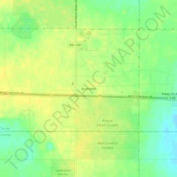
Name: Topografische Karte Bushland, Höhe, Relief.
Ort: Bushland, Potter County, Texas, 79012, United States (35.17289 -102.08038 35.21289 -102.04038)
Durchschnittliche Höhe: 1’166 m
Minimale Höhe: 1’152 m
Maximale Höhe: 1’175 m
Bushland is located at 35°11′31″N 102°03′53″W / 35.19194°N 102.06472°W / 35.19194; -102.06472 (35.1919978, -102.0646392), at an elevation of 3,825 feet. The community is situated along Interstate 40, approximately 14 miles west of Amarillo in southwestern Potter County.
Andere topografische Karten
Klicken Sie auf eine Karte, um ihre Topografie, ihre Höhe und ihr Relief anzuzeigen.
Amarillo
United States > Texas > Potter County
Amarillo, Potter County, Texas, United States
Durchschnittliche Höhe: 1’097 m
Amarillo
United States > Texas > Potter County
Amarillo, Potter County, Texas, United States
Durchschnittliche Höhe: 1’097 m
Alibates Flint Quarries National Monument
United States > Texas > Potter County
Alibates Flint Quarries National Monument, Potter County, Texas, 79036, United States
Durchschnittliche Höhe: 947 m
Amarillo
United States > Texas > Potter County > Amarillo
Amarillo, Potter County, Texas, 79105, United States
Durchschnittliche Höhe: 1’090 m