Topografische Karte Bryson
Interaktive Karte
Klicken Sie auf die Karte, um die Höhe anzuzeigen.
Über diese Karte
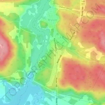
Name: Topografische Karte Bryson, Höhe, Relief.
Ort: Bryson, Pontiac, Outaouais, Quebec, J0X 1H0, Canada (45.65329 -76.63023 45.68277 -76.60094)
Durchschnittliche Höhe: 140 m
Minimale Höhe: 84 m
Maximale Höhe: 198 m
Andere topografische Karten
Klicken Sie auf eine Karte, um ihre Topografie, ihre Höhe und ihr Relief anzuzeigen.
Greer Mount
Canada > Quebec > Pontiac > Thorne
Greer Mount, Thorne, Pontiac, Outaouais, Quebec, Canada
Durchschnittliche Höhe: 261 m
Lac Rueckwald
Canada > Quebec > Pontiac > Thorne
Lac Rueckwald, Thorne, Pontiac, Outaouais, Quebec, Canada
Durchschnittliche Höhe: 223 m
Bristol Mines
Canada > Quebec > Pontiac > Bristol
Bristol Mines, Bristol, Pontiac, Outaouais, Quebec, J0X 1G0, Canada
Durchschnittliche Höhe: 93 m
Lac Sopwith
Canada > Quebec > Pontiac > Otter Lake
Lac Sopwith, Otter Lake, Pontiac, Outaouais, Quebec, Canada
Durchschnittliche Höhe: 275 m
L'Isle-aux-Allumettes
L'Isle-aux-Allumettes, Pontiac, Outaouais, Quebec, Canada
Durchschnittliche Höhe: 148 m
Lac Antiquois
Canada > Quebec > Pontiac > Lac-Nilgaut
Lac Antiquois, Lac-Nilgaut, Pontiac, Outaouais, Quebec, Canada
Durchschnittliche Höhe: 366 m
Otter Lake
Otter Lake, Pontiac, Outaouais, Quebec, J0X 2P0, Canada
Durchschnittliche Höhe: 262 m
Danford Lake
Canada > Quebec > Pontiac > Alleyn-et-Cawood
Danford Lake, Alleyn-et-Cawood, Pontiac, Outaouais, Quebec, J0X 1P0, Canada
Durchschnittliche Höhe: 210 m