Geolokalisieren

Topografische Karte Bronson

Interaktive Karte

Klicken Sie auf die Karte, um die Höhe anzuzeigen.

Über diese Karte

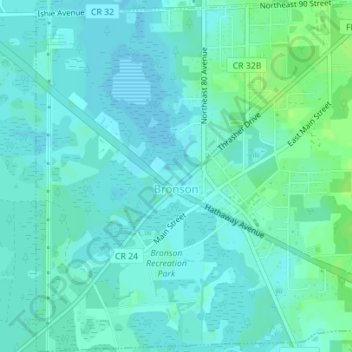
Name: Topografische Karte Bronson, Höhe, Relief.

Ort: Bronson, Levy County, Florida, United States (29.43373 -82.65621 29.46401 -82.62282)

Durchschnittliche Höhe: 21 m

Minimale Höhe: 17 m

Maximale Höhe: 28 m

Andere topografische Karten

Klicken Sie auf eine Karte, um ihre Topografie, ihre Höhe und ihr Relief anzuzeigen.

Cedar Key

United States > Florida > Levy County

Cedar Key, Levy County, Florida, United States

Durchschnittliche Höhe: 2 m

Goethe State Forest

United States > Florida > Levy County > Newberry

Goethe State Forest, Newberry, Levy County, Florida, United States

Durchschnittliche Höhe: 17 m

Otter Creek

United States > Florida > Levy County

Otter Creek, Levy County, Florida, 32683, United States

Durchschnittliche Höhe: 8 m

Williston

United States > Florida > Levy County

Williston, Levy County, Florida, United States

Durchschnittliche Höhe: 23 m

Yankeetown

United States > Florida > Levy County > Yankeetown

Yankeetown, Levy County, Florida, 34498, United States

Durchschnittliche Höhe: 6 m

Morriston

United States > Florida > Levy County

Morriston, Levy County, Florida, United States

Durchschnittliche Höhe: 20 m

Inglis

United States > Florida > Levy County

Inglis, Levy County, Florida, United States

Durchschnittliche Höhe: 10 m

Fanning Springs

United States > Florida > Levy County

Fanning Springs, Levy County, Florida, United States

Durchschnittliche Höhe: 9 m