Topografische Karte Division No. 14
Klicken Sie auf die Karte, um die Höhe anzuzeigen.
Über diese Karte
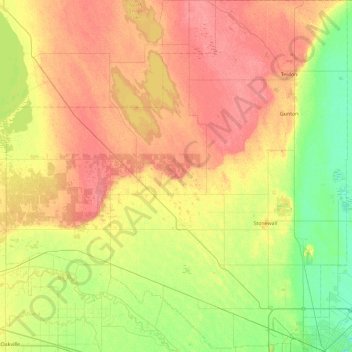
Name: Topografische Karte Division No. 14, Höhe, Relief.
Ort: Division No. 14, Manitoba, Canada (49.91656 -98.00903 50.50689 -97.11342)
Durchschnittliche Höhe: 253 m
Minimale Höhe: 227 m
Maximale Höhe: 280 m
Andere topografische Karten
Klicken Sie auf eine Karte, um ihre Topografie, ihre Höhe und ihr Relief anzuzeigen.




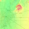
Red River Floodway
Canada > Manitoba > Rural Municipality of Springfield > Winnipeg
Durchschnittliche Höhe: 236 m











Rural Municipality of Minto - Odanah
Canada > Manitoba > Division No. 15
Durchschnittliche Höhe: 587 m

Clear Lake
Canada > Manitoba > Division No. 18 > Rural Municipality of Grahamdale
Durchschnittliche Höhe: 251 m
Easterville
Canada > Manitoba > Division No. 21 > Unorganized Division No. 21
Durchschnittliche Höhe: 260 m
Riding Mountain National Park
The climate in the Riding Mountain region is similar to that of other regions of southwestern Manitoba. Under the Köppen classification it has a continental climate. It includes grasslands, upland boreal and eastern deciduous forest ecosystems. The park has hot summers and cold winters, with annual rainfall…
Durchschnittliche Höhe: 488 m
Rowland Lake
Canada > Manitoba > Division No. 15 > Rural Municipality of Rosedale
Durchschnittliche Höhe: 692 m
Bélair
Canada > Manitoba > Division No. 1 > Rural Municipality of Alexander
Durchschnittliche Höhe: 256 m
Bakers Narrows
Canada > Manitoba > Division No. 21 > Unorganized Division No. 21
Durchschnittliche Höhe: 297 m
Elphinstone
Canada > Manitoba > Division No. 15 > Rural Municipality of Yellowhead
Durchschnittliche Höhe: 583 m


West Hawk Lake
Canada > Manitoba > Division No. 1 > Unorganized Division No. 1
Durchschnittliche Höhe: 349 m


Onanole
Canada > Manitoba > Division No. 15 > Municipality of Harrison Park
Durchschnittliche Höhe: 627 m




Wasagaming
Canada > Manitoba > Unorganized Division No. 17
Wasagaming has a subarctic climate (Dfc) due to its northerly location and high elevation. Winters are extremely cold and relatively dry with little chance of a mid-winter thaw. The average annual temperature is 0.7 °C (33.3 °F). Annual precipitation is 488 mm (19.2 in).
Durchschnittliche Höhe: 630 m