
Topografische Karte Middlechurch
Klicken Sie auf die Karte, um die Höhe anzuzeigen.
Über diese Karte
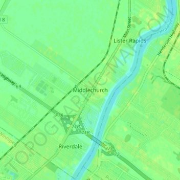
Name: Topografische Karte Middlechurch, Höhe, Relief.
Durchschnittliche Höhe: 231 m
Minimale Höhe: 224 m
Maximale Höhe: 236 m
Andere topografische Karten
Klicken Sie auf eine Karte, um ihre Topografie, ihre Höhe und ihr Relief anzuzeigen.
Winnipeg
Winnipeg lies at the bottom of the Red River Valley, a flood plain with an extremely flat topography. It is on the eastern edge of the Canadian Prairies in Western Canada and is known as the "Gateway to the West". Winnipeg is bordered by tallgrass prairie to the west and south and the aspen parkland to the…
Durchschnittliche Höhe: 236 m
West Shoal Lake
Canada > Manitoba > Division No. 18 > Rural Municipality of St. Laurent
Durchschnittliche Höhe: 262 m
Nutimik Lake
Canada > Manitoba > Division No. 1 > Unorganized Division No. 1
Durchschnittliche Höhe: 282 m