
Topografische Karte Portland
Interaktive Karte
Klicken Sie auf die Karte, um die Höhe anzuzeigen.
Über diese Karte
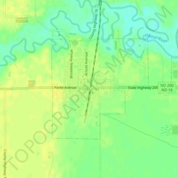
Name: Topografische Karte Portland, Höhe, Relief.
Ort: Portland, Traill County, North Dakota, 58274, United States (47.49062 -97.37876 47.50590 -97.35701)
Durchschnittliche Höhe: 300 m
Minimale Höhe: 288 m
Maximale Höhe: 307 m
Andere topografische Karten
Klicken Sie auf eine Karte, um ihre Topografie, ihre Höhe und ihr Relief anzuzeigen.
Hillsboro
United States > North Dakota > Traill County
Hillsboro, Traill County, North Dakota, United States
Durchschnittliche Höhe: 276 m
Hatton
United States > North Dakota > Traill County
Hatton, Traill County, North Dakota, United States
Durchschnittliche Höhe: 329 m
Mayville
United States > North Dakota > Traill County
Mayville, Traill County, North Dakota, 58257, United States
Durchschnittliche Höhe: 296 m