Geolokalisieren

Topografische Karten Genoa

Klicken Sie auf eine Karte, um ihre Topografie, ihre Höhe und ihr Relief anzuzeigen.
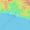
Genoa

Italy > Liguria > Genoa > Genoa

The city of Genoa covers an area of 243 square kilometres (94 sq mi) between the Ligurian Sea and the Apennine Mountains. The city stretches along the coast for about 30 kilometres (19 mi) from the neighbourhood of Voltri to Nervi, and for 10 kilometres (6.2 mi) from the coast to the north along the valleys…

Durchschnittliche Höhe: 247 m

Santo Stefano d'Aveto

Italy > Liguria > Genoa

Durchschnittliche Höhe: 1’166 m

Sori

Italy > Liguria > Genoa

Durchschnittliche Höhe: 328 m

Neirone

Italy > Liguria > Genoa

Durchschnittliche Höhe: 696 m

Arenzano

Italy > Liguria > Genoa

Durchschnittliche Höhe: 335 m

Ligurian Apennines

Italy > Liguria > Genoa > Rezzoaglio

Durchschnittliche Höhe: 1’187 m

Casella

Italy > Liguria > Genoa

Durchschnittliche Höhe: 503 m

Borzonasca

Italy > Liguria > Genoa

Durchschnittliche Höhe: 831 m

Erzelli

Italy > Liguria > Genoa > Genoa

Durchschnittliche Höhe: 52 m

Lumarzo

Italy > Liguria > Genoa

Durchschnittliche Höhe: 539 m

Zoagli

Italy > Liguria > Genoa

Durchschnittliche Höhe: 222 m

Colla di Praglia

Italy > Liguria > Genoa > Ceranesi

Durchschnittliche Höhe: 770 m

Lago Riane

Italy > Liguria > Genoa > Santo Stefano d'Aveto

Durchschnittliche Höhe: 1’333 m

Ferriera

Italy > Liguria > Genoa > Arenzano

Durchschnittliche Höhe: 47 m

Über diesen Ort

 •  •  •  •

Rüste dich für dein nächstes Abenteuer:

🥾Wanderschuhe Damen - Komfortable Wanderschuhe mit gutem Grip für lange Wanderungen
👖Zipp-Off Wanderhosen - Flexibilität bei wechselndem Bergwetter
🍼Edelstahl-Trinkflaschen - Nachhaltig und robust für jede Outdoor-Aktivität
🏃‍♂️Trailrunning‑Schuhe - Schuhe für Läufe auf Berg‑ und Waldwegen
⛺Leichtgewichts-Zelte - Kompakte Zelte für Solo-Abenteurer und Trekking

Als Amazon-Partner verdient diese Seite an qualifizierten Käufen, ohne dass Ihnen zusätzliche Kosten entstehen.