Geolokalisieren

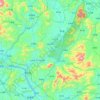
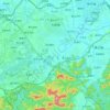
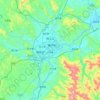
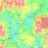
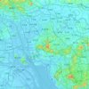
Topografische Karte Conghua

Klicken Sie auf die Karte, um die Höhe anzuzeigen.

Über diese Karte

Name: Topografische Karte Conghua, Höhe, Relief.

Ort: Conghua, Guangzhou City, Guangdong, China (23.39088 113.42046 23.71088 113.74046)

Durchschnittliche Höhe: 121 m

Minimale Höhe: 8 m

Maximale Höhe: 891 m

Andere topografische Karten

Klicken Sie auf eine Karte, um ihre Topografie, ihre Höhe und ihr Relief anzuzeigen.

Shunde District

China > Guangdong > Shunde

Durchschnittliche Höhe: 4 m

Pingshi Town

China > Guangdong > Lechang City

Durchschnittliche Höhe: 302 m

Shenzhen

China > Guangdong

Durchschnittliche Höhe: 30 m

Heyuan

China > Guangdong

Durchschnittliche Höhe: 303 m

Shilong Town

China > Guangdong > Dongguan

Durchschnittliche Höhe: 7 m

Qi'ao

China > Guangdong > Xiangzhou > Tangjiawan

Durchschnittliche Höhe: 10 m

Futian District

China > Guangdong

Durchschnittliche Höhe: 48 m

Futian District

China > Guangdong

Durchschnittliche Höhe: 48 m

Pearl River

China > Guangdong > Guangzhou City

Durchschnittliche Höhe: 16 m

Pingfeng

China > Guangdong > Fengkai County > Zhaoqing City

Durchschnittliche Höhe: 77 m

Fengkai County

China > Guangdong > Zhaoqing City

Durchschnittliche Höhe: 190 m

Nanshan District

China > Guangdong > Shenzhen

At 587 metres (1,926 ft) tall, Yangtaishan has the highest elevation in the district, with Tanglangshan being the second at 430 metres (1,411 ft), and Nanshan, third, at 336 metres (1,102 ft). The district has a total coastline of 55.18 kilometres (34.29 mi).

Durchschnittliche Höhe: 40 m
Zhangmutou Town

China > Guangdong > Dongguan

Durchschnittliche Höhe: 88 m

Dalang Town

China > Guangdong > Dongguan

Durchschnittliche Höhe: 37 m

Bao'an District

China > Guangdong > Shenzhen

Durchschnittliche Höhe: 39 m

Huangjiang Town

China > Guangdong > Dongguan

Durchschnittliche Höhe: 62 m

Maoming City

China > Guangdong

Durchschnittliche Höhe: 133 m

Zhuhai

China > Guangdong

Durchschnittliche Höhe: 19 m

Tianhe District

China > Guangdong

Durchschnittliche Höhe: 53 m

Yuexiu Park

China > Guangdong > Yuexiu District

Durchschnittliche Höhe: 24 m

Haizhu District

China > Guangdong

Durchschnittliche Höhe: 11 m

Guangzhou City

China > Guangdong

The elevation of the prefecture generally increases from southwest to northeast, with mountains forming the backbone of the city and the ocean comprising the front. Tiantang Peak is the highest point of elevation at 1,210 metres (3,970 feet) above sea level.

Durchschnittliche Höhe: 98 m

Huangbu

China > Guangdong > Huidong County > Huizhou

Durchschnittliche Höhe: 51 m

Haizhu District

China > Guangdong

Durchschnittliche Höhe: 11 m

Shenshan Special Cooperation Zone

China > Guangdong

Durchschnittliche Höhe: 39 m

Shenzhen

China > Guangdong

Durchschnittliche Höhe: 30 m

Zhanjiang City

China > Guangdong

Durchschnittliche Höhe: 38 m

Meijiang District

China > Guangdong > Meizhou

Durchschnittliche Höhe: 242 m

Meijiang District

China > Guangdong > Meizhou

Durchschnittliche Höhe: 242 m

Meijiang District

China > Guangdong > Meizhou

Durchschnittliche Höhe: 242 m

Futian District

China > Guangdong > Shenzhen

Durchschnittliche Höhe: 48 m

Meijiang District

China > Guangdong > Meizhou

Durchschnittliche Höhe: 242 m

Meijiang District

China > Guangdong > Meizhou

Durchschnittliche Höhe: 242 m

Huizhou

China > Guangdong

Durchschnittliche Höhe: 113 m

Meijiang District

China > Guangdong > Meizhou

Durchschnittliche Höhe: 242 m

Meijiang District

China > Guangdong > Meizhou

Durchschnittliche Höhe: 242 m

Longgang District

China > Guangdong > Shenzhen

Durchschnittliche Höhe: 29 m

Meijiang District

China > Guangdong > Meizhou

Durchschnittliche Höhe: 242 m

Meijiang District

China > Guangdong > Meizhou

Durchschnittliche Höhe: 242 m

Meijiang District

China > Guangdong > Meizhou

Durchschnittliche Höhe: 242 m

Shantou

China > Guangdong

Durchschnittliche Höhe: 44 m

Guangzhou City

China > Guangdong

The elevation of the prefecture generally increases from southwest to northeast, with mountains forming the backbone of the city and the ocean comprising the front. Tiantang Peak (simplified Chinese: 天堂顶; traditional Chinese: 天堂頂, "Heavenly Peak") is the highest point of elevation at 1,210 m (3,970…

Durchschnittliche Höhe: 98 m

Shenzhen

China > Guangdong

Durchschnittliche Höhe: 30 m

Zhuhai

China > Guangdong

Durchschnittliche Höhe: 19 m

Longhua District

China > Guangdong > Shenzhen

Durchschnittliche Höhe: 81 m

Guangzhou City

China > Guangdong

The elevation of the prefecture generally increases from southwest to northeast, with mountains forming the backbone of the city and the ocean comprising the front. Tiantang Peak (simplified Chinese: 天堂顶; traditional Chinese: 天堂頂, "Heavenly Peak") is the highest point of elevation at 1,210 m (3,970…

Durchschnittliche Höhe: 98 m

Xinxing County

China > Guangdong

Durchschnittliche Höhe: 198 m

Shaxi

China > Guangdong > Zhongshan

Durchschnittliche Höhe: 8 m

Nansha District

China > Guangdong > Guangzhou City

Durchschnittliche Höhe: 5 m

Meijiang District

China > Guangdong > Meizhou

Durchschnittliche Höhe: 242 m

Chaozhou

China > Guangdong

The Chaozhou territory is mountainous. In particular, the nearby Phoenix Mountain's peak is located 1,497 meters (4,911 ft) above sea level. The main nearby rivers are the Huanggang River and the Han River. The Han River flows from west to southeast, and ramps through downtown Chaozhou; the Huanggang river…

Durchschnittliche Höhe: 229 m

Mirs Bay

China > Guangdong

Durchschnittliche Höhe: 53 m

Guangming District

China > Guangdong > Shenzhen

Durchschnittliche Höhe: 55 m

Nanshan District

China > Guangdong > Shenzhen

At 587 metres (1,926 ft) tall, Yangtaishan has the highest elevation in the district, with Tanglangshan being the second at 430 metres (1,411 ft), and Nanshan, third, at 336 metres (1,102 ft). The district has a total coastline of 55.18 kilometres (34.29 mi).

Durchschnittliche Höhe: 35 m

Tianhe District

China > Guangdong

Durchschnittliche Höhe: 53 m

Chikan

China > Guangdong > Kaiping > Jiangmen

Durchschnittliche Höhe: 13 m

Zhuhai

China > Guangdong

Durchschnittliche Höhe: 19 m

Shenzhen

China > Guangdong

Durchschnittliche Höhe: 30 m

Qingyuan City

China > Guangdong

Qingyuan's administrative area ranges in latitude from 23° 26' 56" to 25° 11' 40" N, and in longitude from 111° 55' 17" to 113° 55' 34" E; its urban area is located just north of the Tropic of Cancer, about 60 km (37 mi) from the urban area of Guangzhou and 200 km (120 mi) from both Hong Kong and Macau.…

Durchschnittliche Höhe: 349 m

Guangzhou City

China > Guangdong

The elevation of the prefecture generally increases from southwest to northeast, with mountains forming the backbone of the city and the ocean comprising the front. Tiantang Peak (simplified Chinese: 天堂顶; traditional Chinese: 天堂頂, "Heavenly Peak") is the highest point of elevation at 1,210 m (3,970…

Durchschnittliche Höhe: 98 m

Nanshan District

China > Guangdong > Shenzhen

At 587 metres (1,926 ft) tall, Yangtaishan has the highest elevation in the district, with Tanglangshan being the second at 430 metres (1,411 ft), and Nanshan, third, at 336 metres (1,102 ft). The district has a total coastline of 55.18 kilometres (34.29 mi).

Durchschnittliche Höhe: 35 m

Shigou

China > Guangdong > Sihui > Zhaoqing City

Durchschnittliche Höhe: 110 m

Deep Bay - Shenzhen Bay

China > Guangdong > Hong Kong

Durchschnittliche Höhe: 24 m

Zhanjiang City

China > Guangdong

Durchschnittliche Höhe: 38 m

Guangzhou City

China > Guangdong

The elevation of the prefecture generally increases from southwest to northeast, with mountains forming the backbone of the city and the ocean comprising the front. Tiantang Peak is the highest point of elevation at 1,210 metres (3,970 feet) above sea level.

Durchschnittliche Höhe: 98 m
Chancheng District

China > Guangdong > Foshan

The district lies at the center of Foshan, surrounded on the east, west, and north sides by the Nanhai District and bordered to the south by the Shunde District. Chancheng District is located in the hinterland of the Pearl River Delta, southwest of Guangzhou and central Foshan, bordering Nanhai District to the…

Durchschnittliche Höhe: 5 m

Shantou

China > Guangdong

Durchschnittliche Höhe: 44 m

Pearl River

China > Guangdong

Durchschnittliche Höhe: 20 m

Yingde City

China > Guangdong

Durchschnittliche Höhe: 283 m

Lianzhou

China > Guangdong > Qingyuan City

Durchschnittliche Höhe: 489 m

Xiangzhou

China > Guangdong

Durchschnittliche Höhe: 13 m

Zhaoqing City

China > Guangdong

Durchschnittliche Höhe: 200 m

Shenzhen

China > Guangdong

Durchschnittliche Höhe: 30 m

Hengqin Flower Sea Corridor

China > Guangdong > Xiangzhou

Durchschnittliche Höhe: 0 m

Shenzhen

China > Guangdong

Durchschnittliche Höhe: 48 m

Meizhou

China > Guangdong

Meizhou has a humid subtropical climate (Köppen Cfa), with short, mild, overcast winters and long, very hot, humid summers. The monthly daily average temperature in January is 12.6 °C (54.7 °F), and in July is 28.9 °C (84.0 °F). From April to June, rainfall is the heaviest and most frequent. Though…

Durchschnittliche Höhe: 297 m

Hengqin Flower Sea Corridor

China > Guangdong > Xiangzhou

Durchschnittliche Höhe: 0 m

Meiling

China > Guangdong > Futian District

Durchschnittliche Höhe: 17 m

Shantou

China > Guangdong

Durchschnittliche Höhe: 44 m

Zhuhai

China > Guangdong

Durchschnittliche Höhe: 19 m

Deqing County

China > Guangdong > Zhaoqing City

Durchschnittliche Höhe: 218 m

Lianghua

China > Guangdong > Huidong County > Huizhou

Durchschnittliche Höhe: 113 m

Zhaoqing City

China > Guangdong

Durchschnittliche Höhe: 200 m

Shunde District

China > Guangdong > Shunde

Durchschnittliche Höhe: 5 m

Shangchuan Island

China > Guangdong > Jiangmen

Durchschnittliche Höhe: 27 m

Dongguan

China > Guangdong

Durchschnittliche Höhe: 24 m

Shenzhen

China > Guangdong

Durchschnittliche Höhe: 30 m

Baiyun District

China > Guangdong

Durchschnittliche Höhe: 30 m

Haizhu District

China > Guangdong

Durchschnittliche Höhe: 11 m

Longhua District

China > Guangdong > Shenzhen

Durchschnittliche Höhe: 81 m

Tianhe District

China > Guangdong

Durchschnittliche Höhe: 53 m

Zengcheng District

China > Guangdong > Guangzhou City

Durchschnittliche Höhe: 106 m

Haizhu District

China > Guangdong

Durchschnittliche Höhe: 11 m

Nansha District

China > Guangdong > Guangzhou City

Durchschnittliche Höhe: 12 m

People's Park

China > Guangdong > Yuexiu District

Durchschnittliche Höhe: 20 m

Yangjiang City

China > Guangdong

Durchschnittliche Höhe: 66 m

Tanzhou

China > Guangdong > Zhongshan

Durchschnittliche Höhe: 31 m

Qingyuan City

China > Guangdong

Qingyuan's administrative area ranges in latitude from 23° 26' 56" to 25° 11' 40" N, and in longitude from 111° 55' 17" to 113° 55' 34" E; its urban area is located just north of the Tropic of Cancer, about 60 km (37 mi) from the urban area of Guangzhou and 200 km (120 mi) from both Hong Kong and Macau.…

Durchschnittliche Höhe: 349 m

Baiyun District

China > Guangdong

Durchschnittliche Höhe: 30 m

Rüste dich für dein nächstes Abenteuer:

🧥Leichte Regenjacken - Minimales Packmass bei maximalem Schutz vor Regenschauern
🥾Ausrüstung für leichtes Wandern - Ultraleichte Ausrüstung für schnelle Touren
🧥Outdoor-Westen - Kernwärme bei voller Bewegungsfreiheit der Arme
🦯Trekkingstöcke - Entlastung für die Knie beim Abstieg in steilem Gelände
🏒Eispickel - Notwendige Sicherheit für winterliche Hochtouren

Als Amazon-Partner verdient diese Seite an qualifizierten Käufen, ohne dass Ihnen zusätzliche Kosten entstehen.