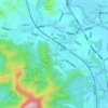
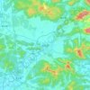
Topografische Karte Qingyuan City
Klicken Sie auf die Karte, um die Höhe anzuzeigen.
Qingyuan City
Qingyuan's administrative area ranges in latitude from 23° 26' 56" to 25° 11' 40" N, and in longitude from 111° 55' 17" to 113° 55' 34" E; its urban area is located just north of the Tropic of Cancer, about 60 km (37 mi) from the urban area of Guangzhou and 200 km (120 mi) from both Hong Kong and Macau. Its area of over 19,000 km2 (7,300 sq mi) accounts for 10.6% of the total provincial area. Qingyuan contains part of the southern Nan Ling, and more than half of the area is mountainous, and elevations increase from southeast to northwest. Bordering prefectures are Guangzhou and Foshan to the southeast, Zhaoqing to the southwest, Shaoguan to the north and northeast, Hezhou (Guangxi) to the west, and Yongzhou and Chenzhou (Hunan) to the north.
Über diese Karte

Name: Topografische Karte Qingyuan City, Höhe, Relief.
Ort: Qingyuan City, Guangdong, China (23.44860 111.92230 25.19432 113.92617)
Durchschnittliche Höhe: 349 m
Minimale Höhe: 3 m
Maximale Höhe: 1’830 m
Andere topografische Karten
Klicken Sie auf eine Karte, um ihre Topografie, ihre Höhe und ihr Relief anzuzeigen.







Mount Yangtai
The Mount Yangtai (Chinese: 羊台山; pinyin: Yángtaíshān), also known as Mount Yangtai Forest Park, is a mountain at the junction of Bao'an District and Nanshan District in Shenzhen, Guangdong, China. The peak is 587.3 metres (1,927 ft) in elevation, which is the highest peak in western Shenzhen. In 2008…
Durchschnittliche Höhe: 287 m