
Topografische Karte Waltham
Interaktive Karte
Klicken Sie auf die Karte, um die Höhe anzuzeigen.
Über diese Karte
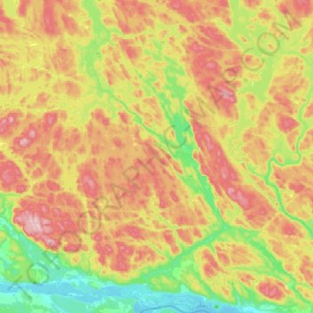
Name: Topografische Karte Waltham, Höhe, Relief.
Ort: Waltham, Pontiac, Outaouais, Quebec, J0X 3H0, Canada (45.89225 -77.04870 46.16432 -76.79797)
Durchschnittliche Höhe: 245 m
Minimale Höhe: 104 m
Maximale Höhe: 409 m
Its territory, with a maximum elevation of just over 350 metres (1,150 ft), is sparsely populated, the majority of the population living along or near the Ottawa River. The northern portion is a vast extended tract of undeveloped land, dotted with lakes, such as Findlay, Landon, Gagnon, and Caughlin, which are popular for fishing.
Andere topografische Karten
Klicken Sie auf eine Karte, um ihre Topografie, ihre Höhe und ihr Relief anzuzeigen.
Greer Mount
Canada > Quebec > Pontiac > Thorne
Greer Mount, Thorne, Pontiac, Outaouais, Quebec, Canada
Durchschnittliche Höhe: 261 m
Lac Rueckwald
Canada > Quebec > Pontiac > Thorne
Lac Rueckwald, Thorne, Pontiac, Outaouais, Quebec, Canada
Durchschnittliche Höhe: 223 m
Bristol Mines
Canada > Quebec > Pontiac > Bristol
Bristol Mines, Bristol, Pontiac, Outaouais, Quebec, J0X 1G0, Canada
Durchschnittliche Höhe: 93 m
Lac Sopwith
Canada > Quebec > Pontiac > Otter Lake
Lac Sopwith, Otter Lake, Pontiac, Outaouais, Quebec, Canada
Durchschnittliche Höhe: 275 m
L'Isle-aux-Allumettes
L'Isle-aux-Allumettes, Pontiac, Outaouais, Quebec, Canada
Durchschnittliche Höhe: 148 m
Lac Antiquois
Canada > Quebec > Pontiac > Lac-Nilgaut
Lac Antiquois, Lac-Nilgaut, Pontiac, Outaouais, Quebec, Canada
Durchschnittliche Höhe: 366 m
Otter Lake
Otter Lake, Pontiac, Outaouais, Quebec, J0X 2P0, Canada
Durchschnittliche Höhe: 262 m
Danford Lake
Canada > Quebec > Pontiac > Alleyn-et-Cawood
Danford Lake, Alleyn-et-Cawood, Pontiac, Outaouais, Quebec, J0X 1P0, Canada
Durchschnittliche Höhe: 210 m