
Topografische Karte Dingwall Island
Klicken Sie auf die Karte, um die Höhe anzuzeigen.
Über diese Karte
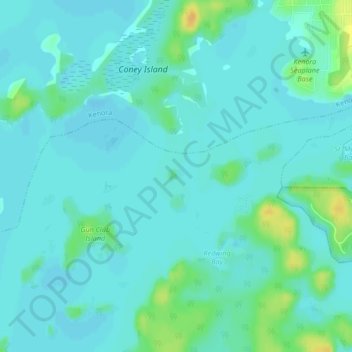
Name: Topografische Karte Dingwall Island, Höhe, Relief.
Durchschnittliche Höhe: 325 m
Minimale Höhe: 319 m
Maximale Höhe: 346 m
Andere topografische Karten
Klicken Sie auf eine Karte, um ihre Topografie, ihre Höhe und ihr Relief anzuzeigen.
Shoal Lake
Canada > Ontario > Kenora District > Unorganized Kenora District
Durchschnittliche Höhe: 325 m
lac Seul
Canada > Ontario > Kenora District > Unorganized Kenora District
Lac Seul is a large, crescent shaped reservoir in Kenora District, northwestern Ontario, Canada. It is approximately 241 km (150 mi) long. It has a maximum (regulated) depth of 47.2 m, with a surface elevation of 357 m above sea level. Its level is raised in the summer and then drawn down in the winter months…
Durchschnittliche Höhe: 374 m
Big Canon Lake
Canada > Ontario > Kenora District > Unorganized Kenora District
Durchschnittliche Höhe: 363 m
Star Lake
Canada > Ontario > Kenora District > Unorganized Kenora District
Durchschnittliche Höhe: 382 m
MacDowell Lake
Canada > Ontario > Kenora District > Unorganized Kenora District
Durchschnittliche Höhe: 386 m
Rowdy Lake
Canada > Ontario > Kenora District > Unorganized Kenora District
Durchschnittliche Höhe: 370 m
Lake Charles
Canada > Ontario > Kenora District > Unorganized Kenora District
Durchschnittliche Höhe: 346 m
Fiddler Lake
Canada > Ontario > Kenora District > Unorganized Kenora District
Durchschnittliche Höhe: 293 m
Wabigoon
Canada > Ontario > Kenora District > Unorganized Kenora District
Durchschnittliche Höhe: 381 m
Hudson Bay Lowlands
Canada > Ontario > Kenora District > Unorganized Kenora District
Durchschnittliche Höhe: 17 m
Dinorwic
Canada > Ontario > Kenora District > Unorganized Kenora District
Durchschnittliche Höhe: 383 m
Minnitaki Lake
Canada > Ontario > Kenora District > Unorganized Kenora District
Durchschnittliche Höhe: 386 m
Dogtooth Lake
Canada > Ontario > Kenora District > Unorganized Kenora District
Durchschnittliche Höhe: 361 m
Artery Lake
Canada > Ontario > Kenora District > Unorganized Kenora District
Durchschnittliche Höhe: 334 m
Betula Lake
Canada > Ontario > Kenora District > Unorganized Kenora District
Durchschnittliche Höhe: 371 m
Lac Seul
Canada > Ontario > Kenora District > Unorganized Kenora District
Durchschnittliche Höhe: 371 m
Maynard Lake
Canada > Ontario > Kenora District > Unorganized Kenora District
Durchschnittliche Höhe: 337 m
Clearwater Bay
Canada > Ontario > Kenora District > Unorganized Kenora District
Durchschnittliche Höhe: 334 m
Whitefish Lake
Canada > Ontario > Kenora District > Unorganized Kenora District
Durchschnittliche Höhe: 380 m
Slate Falls
Canada > Ontario > Kenora District > Unorganized Kenora District
Durchschnittliche Höhe: 385 m
Wabauskang 21
Canada > Ontario > Kenora District > Unorganized Kenora District
Durchschnittliche Höhe: 368 m
Canyon Lake
Canada > Ontario > Kenora District > Unorganized Kenora District
Durchschnittliche Höhe: 405 m
Axe Lake
Canada > Ontario > Kenora District > Unorganized Kenora District
Durchschnittliche Höhe: 369 m
Kushog Lake
Canada > Ontario > Kenora District > Unorganized Kenora District
Durchschnittliche Höhe: 405 m
Confederation Lake
Canada > Ontario > Kenora District > Unorganized Kenora District
Durchschnittliche Höhe: 414 m
Fredart Lake
Canada > Ontario > Kenora District > Unorganized Kenora District
Durchschnittliche Höhe: 409 m
Two Island Lake
Canada > Ontario > Kenora District > Unorganized Kenora District
Durchschnittliche Höhe: 361 m
Affleck Lake
Canada > Ontario > Kenora District > Unorganized Kenora District
Durchschnittliche Höhe: 421 m
Spadina Lake
Canada > Ontario > Kenora District > Unorganized Kenora District
Durchschnittliche Höhe: 376 m
Ena Lake
Canada > Ontario > Kenora District > Unorganized Kenora District
Durchschnittliche Höhe: 350 m
McIntosh Lake
Canada > Ontario > Kenora District > Unorganized Kenora District
Durchschnittliche Höhe: 395 m
Oxdrift
Canada > Ontario > Kenora District > Unorganized Kenora District
Durchschnittliche Höhe: 364 m
Gordon Island
Canada > Ontario > Kenora District > Unorganized Kenora District
Durchschnittliche Höhe: 349 m
Blackstone Lake
Canada > Ontario > Kenora District > Unorganized Kenora District
Durchschnittliche Höhe: 382 m
Bass Lake
Canada > Ontario > Kenora District > Unorganized Kenora District
Durchschnittliche Höhe: 387 m
Winnipeg River
Canada > Ontario > Kenora District > Unorganized Kenora District
Durchschnittliche Höhe: 317 m
Cygnet Lake
Canada > Ontario > Kenora District > Unorganized Kenora District
Durchschnittliche Höhe: 339 m
West Arm
Canada > Ontario > Kenora District > Unorganized Kenora District
Durchschnittliche Höhe: 379 m
Brock Lake
Canada > Ontario > Kenora District > Unorganized Kenora District
Durchschnittliche Höhe: 311 m
Bertrand Lake
Canada > Ontario > Kenora District > Unorganized Kenora District
Durchschnittliche Höhe: 414 m
Stormy Lake
Canada > Ontario > Kenora District > Unorganized Kenora District
Durchschnittliche Höhe: 414 m
Mackey Island
Canada > Ontario > Kenora District > Unorganized Kenora District
Durchschnittliche Höhe: 336 m
Snelgrove Lake
Canada > Ontario > Kenora District > Unorganized Kenora District
Durchschnittliche Höhe: 408 m
Eagle Lake
Canada > Ontario > Kenora District > Unorganized Kenora District
Durchschnittliche Höhe: 379 m
Wabaskang Lake
Canada > Ontario > Kenora District > Unorganized Kenora District
Durchschnittliche Höhe: 375 m
Minnitaki Lake
Canada > Ontario > Kenora District > Unorganized Kenora District
Durchschnittliche Höhe: 386 m
Thaddeus
Canada > Ontario > Kenora District > Unorganized Kenora District
Durchschnittliche Höhe: 411 m
Kukukus Lake
Canada > Ontario > Kenora District > Unorganized Kenora District
Durchschnittliche Höhe: 405 m
Antenna Lake
Canada > Ontario > Kenora District > Unorganized Kenora District
Durchschnittliche Höhe: 393 m
Cluster Lakes
Canada > Ontario > Kenora District > Unorganized Kenora District
Durchschnittliche Höhe: 443 m
Swan Lake
Canada > Ontario > Kenora District > Unorganized Kenora District
Durchschnittliche Höhe: 323 m
Cameron Island
Canada > Ontario > Kenora District > Unorganized Kenora District
Durchschnittliche Höhe: 338 m